
Population 3,500 (1992) Founded 1857 | Established 1857 Area 3,464 km² | |
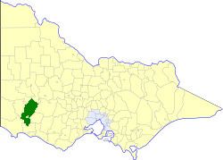 | ||
The Shire of Dundas was a local government area about 300 kilometres (186 mi) west of Melbourne, the state capital of Victoria, Australia. The shire covered an area of 3,464.39 square kilometres (1,337.6 sq mi), and existed from 1857 until 1994.
Contents
History
Dundas was first incorporated as a road district on 4 August 1857, and became a shire on 8 December 1863.
On 23 September 1994, the Shire of Dundas was abolished, and, along with the City of Hamilton, the Shire of Wannon, and parts of the Shire of Mount Rouse, was merged into the newly created Shire of Southern Grampians. The Macarthur hinterland area was transferred into the newly created Shire of Moyne, administered from Port Fairy.
Wards
The Shire of Dundas was divided into three ridings, each of which elected three councillors:
Population
* Estimate in the 1958 Victorian Year Book.