
Population 608 (2013 est) President Gordon Davidson Area 2,540 km² | Established 1909 Founded 1909 | |
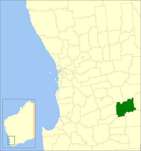 | ||
The Shire of Dumbleyung is a local government area in the Wheatbelt region of Western Australia, about 40 kilometres (25 mi) east of Wagin and about 275 kilometres (171 mi) southeast of Perth, the state capital. The Shire covers an area of 2,540 square kilometres (981 sq mi), and is involved in grain and livestock production and various biodiversity industries including cereals, summer crops, oil mallees, yabbies, emus, poultry and trout. Its seat of government is the town of Dumbleyung.
Contents
Map of Dumbleyung, WA, Australia
History
On 1 October 1909, the Dumbleyung Road District was created. On 1 July 1961, it became a Shire following the enactment of the Local Government Act 1960.
Wards
As of 3 May 2003, the shire has been divided into 4 wards.
Previously, there were 5 wards: Central (Dumbleyung), North (Dongolocking), South (Datatine), Merilup and Kukerin.