
County Shasta FIPS code 06-71568 Elevation 1,057 m Zip code 96088 Area code 474 (530 Exchange) | State California Time zone Pacific (PST) (UTC-8) GNIS feature ID 1659646 Area 64.02 km² Population 2,283 (2010) | |
 | ||
Shingletown california
Shingletown is a census-designated place (CDP) in Shasta County, California, United States. The population was 2,283 at the 2010 census, up from 2,222 at the 2000 census.
Contents
- Shingletown california
- Map of Shingletown CA 96088 USA
- Geography
- Climate
- 2010
- 2000
- Politics
- Education
- Economy
- Notable residents
- References
Map of Shingletown, CA 96088, USA
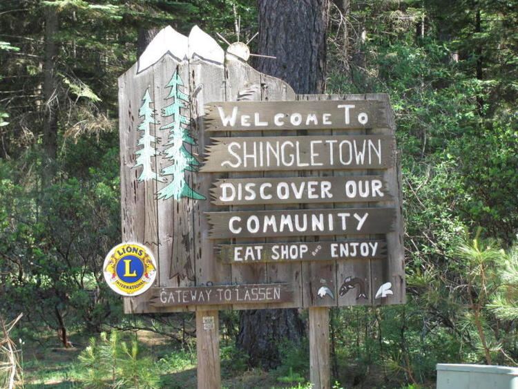
Shingletown is a small town located along California State Route 44 in the hills just below Mount Lassen. Shingletown has a history of logging large timber, including pine, fir and cedar. It is also known as "The Gateway to Lassen".
Geography
Shingletown is located at 40°29′46″N 121°51′49″W (40.496033, -121.863657) in Northern California, near Lassen Volcanic National Park.
According to the United States Census Bureau, the CDP has a total area of 24.7 square miles (64 km2), of which 24.7 square miles (64 km2) is land and 0.1 square miles (0.26 km2) (0.28%) is water.
The forests around Shingletown are home to the Shasta clarkia a rare subspecies of Clarkia borealis, a flowering plant in the evening primrose family.
Climate
This region experiences warm (but not hot) and dry summers, with average monthly temperatures above 71.6 °F. According to the Köppen Climate Classification system, Shingletown has a warm-summer Mediterranean climate, abbreviated "Csb" on climate maps.
2010
The 2010 United States Census reported that Shingletown had a population of 2,283. The population density was 92.4 people per square mile (35.7/km²). The racial makeup of Shingletown was 2,124 (93.0%) White, 5 (0.2%) African American, 49 (2.1%) Native American, 8 (0.4%) Asian, 1 (0.0%) Pacific Islander, 13 (0.6%) from other races, and 83 (3.6%) from two or more races. Hispanic or Latino of any race were 86 persons (3.8%).
The Census reported that 2,283 people (100% of the population) lived in households, 0 (0%) lived in non-institutionalized group quarters, and 0 (0%) were institutionalized.
There were 1,007 households, out of which 188 (18.7%) had children under the age of 18 living in them, 553 (54.9%) were opposite-sex married couples living together, 76 (7.5%) had a female householder with no husband present, 40 (4.0%) had a male householder with no wife present. There were 62 (6.2%) unmarried opposite-sex partnerships, and 7 (0.7%) same-sex married couples or partnerships. 267 households (26.5%) were made up of individuals and 121 (12.0%) had someone living alone who was 65 years of age or older. The average household size was 2.27. There were 669 families (66.4% of all households); the average family size was 2.70.
The population was spread out with 358 people (15.7%) under the age of 18, 124 people (5.4%) aged 18 to 24, 359 people (15.7%) aged 25 to 44, 881 people (38.6%) aged 45 to 64, and 561 people (24.6%) who were 65 years of age or older. The median age was 53.2 years. For every 100 females there were 101.7 males. For every 100 females age 18 and over, there were 99.5 males.
There were 1,263 housing units at an average density of 51.1 per square mile (19.7/km²), of which 839 (83.3%) were owner-occupied, and 168 (16.7%) were occupied by renters. The homeowner vacancy rate was 4.1%; the rental vacancy rate was 13.3%. 1,868 people (81.8% of the population) lived in owner-occupied housing units and 415 people (18.2%) lived in rental housing units.
2000
As of the census of 2000, there were 2,222 people, 913 households, and 677 families residing in the CDP. The population density was 90.1 people per square mile (34.8/km²). There were 1,148 housing units at an average density of 46.5 per square mile (18.0/km²). The racial makeup of the CDP was 92.84% White, 2.39% Native American, 0.36% African American, 0.27% Asian, 0.77% from other races, and 3.38% from two or more races. Hispanic or Latino of any race were 3.42% of the population.
There were 913 households out of which 26.8% had children under the age of 18 living with them, 62.3% were married couples living together, 7.9% had a female householder with no husband present, and 25.8% were non-families. 21.7% of all households were made up of individuals and 9.0% had someone living alone who was 65 years of age or older. The average household size was 2.43 and the average family size was 2.80.
In the CDP, the population was spread out with 23.1% under the age of 18, 4.0% from 18 to 24, 21.2% from 25 to 44, 29.0% from 45 to 64, and 22.6% who were 65 years of age or older. The median age was 46 years. For every 100 females there were 101.8 males. For every 100 females age 18 and over, there were 98.4 males.
The median income for a household in the CDP was $32,813, and the median income for a family was $40,789. Males had a median income of $50,000 versus $26,758 for females. The per capita income for the CDP was $16,303. About 10.3% of families and 12.6% of the population were below the poverty line, including 14.0% of those under age 18 and 6.2% of those age 65 or over...
Politics
In the state legislature Shingletown is located in the 1st Senate District, represented by Republican Ted Gaines, and the 1st Assembly District, represented by Republican Brian Dahle.
Federally, Shingletown is in California's 1st congressional district, represented by Republican Doug LaMalfa.
Education
There are two schools in Shingletown; Black Butte Elementary and Black Butte Junior High School located on Ponderosa Way.
As of the 2010-2011 school year, Shingletown high schoolers attend Foothill High School in Palo Cedro, 23 miles (37 km) from Shingletown.
Economy
Shingletown is home to KRDG and KKXS, two radio stations targeting Redding and the surrounding area.