
Type Natural Reference 578 Area 10,000 km² | Criteria vii, viii, ix, x UNESCO region Asia-Pacific UNESCO World Heritage Site inscription 1991 | |
 | ||
Location Gascoyne region, Western Australia, Australia | ||
Shark Bay is a World Heritage Site in the Gascoyne region of Western Australia. The 2,200,902-hectare (5,438,550-acre) heritage–listed area is located approximately 800 kilometres (500 mi) north of Perth, on the westernmost point of the Australian continent, inscribed as follows:
Contents
- Map of Shark Bay Western Australia Australia
- Goulet bluff campground shark bay western australia
- Shark Bay World Heritage site
- Protected areas
- Landforms
- Fauna
- Flora
- Stromatolites
- Shark Bay World Heritage Discovery Centre
- Access
- National parks and reserves in the World Heritage Area
- Bays of the World Heritage area
- Islands of the World Heritage area
- Peninsulas of the World Heritage area
- IBRA sub regions of the Shark Bay Area
- References
Map of Shark Bay, Western Australia, Australia
The record of Australian Aboriginal occupation of Shark Bay extends to 22,000 years BP. At that time most of the area was dry land, rising sea levels flooding Shark Bay between 8,000 BP and 6,000 BP. A considerable number of aboriginal midden sites have been found, especially on Peron Peninsula and Dirk Hartog Island which provide evidence of some of the foods gathered from the waters and nearby land areas. An expedition led by Dirk Hartog happened upon the area in 1616, becoming the second group of Europeans known to have visited Australia, after the crew of the Duyfken, under Willem Janszoon, visited Cape York in 1606. Shark Bay was named by William Dampier, on 7 August 1699.
The heritage–listed area had a population of fewer than 1,000 people as at the 2011 census and a coastline of over 1,500 kilometres (930 mi). The half-dozen small communities making up this population occupy less than 1% of the total area.
Goulet bluff campground shark bay western australia
Shark Bay World Heritage site
The World Heritage status of the region was created and negotiated in 1991. The site was gazetted on the Australian National Heritage List on 21 May 2007 under the Environment and Heritage Legislation Amendment Act (No. 1), 2003 (Cth).
Protected areas
declared as a World Heritage Site in 1991, the site covers an area of 2,200,902 hectares (5,438,550 acres), of which about 70 per cent are marine waters. It includes many protected areas and conservation reserves, including Shark Bay Marine Park, Francois Peron National Park, Hamelin Pool Marine Nature Reserve, Zuytdorp Nature Reserve and numerous protected islands. Denham and Useless Loop both fall within the boundary of the site, yet are specifically excluded from it. Shark Bay was the first Australian site to be classified on the World Heritage list.
Landforms
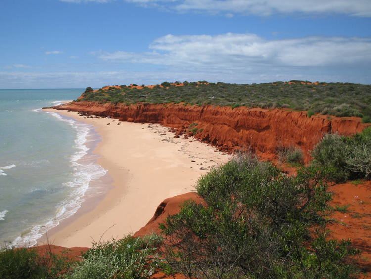
The bay itself covers an area of 1,300,000 hectares (3,200,000 acres), with an average depth of 9 metres (30 ft). It is divided by shallow banks and has many peninsulas and islands. The coastline is over 1,500 kilometres (930 mi) long. There are about 300 kilometres (190 mi) of limestone cliffs overlooking the bay. One spectacular segment of cliffs is known as the Zuytdorp Cliffs. The bay is located in the transition zone between three major climatic regions and between two major botanical provinces.
Dirk Hartog Island is of historical significance due to landings upon it by early explorers. In 1616, Dirk Hartog landed at Inscription Point on the north end of the island and marked his discovery with a pewter plate, inscribed with the date and nailed to a post. This plate was then replaced by Willem de Vlamingh and returned to Holland. It is now kept in the National Museum of Holland. There is a replica in the Shark Bay Discovery Centre in Denham.
Bernier and Dorre islands in the north-west corner of the heritage area are among the last-remaining habitats of Australian mammals threatened with extinction. They are used, with numerous other smaller islands throughout the marine park, to release threatened species that are being bred at Project Eden in François Peron National Park. These islands are free of feral non-native animals which might predate the threatened species, and so provide a safe haven of pristine environment on which to restore species that are threatened on the mainland.
The Australian Wildlife Conservatory is the guardian of Faure Island, off Monkey Mia. Seasonally, sea turtles come here to nest and are the subject of studies conducted in conjunction with the Western Australian Department of Environment and Conservation (DEC) on this sheltered island.
Fauna
Shark Bay is an area of major zoological importance. It is home to about 10,000 dugongs (‘sea cows’), around 12.5% of the world's population, and there are many Indo-Pacific bottlenose dolphins, particularly at Monkey Mia. The dolphins here have been particularly friendly since the 1960s. The area supports 26 threatened Australian mammal species, over 230 species of bird, and nearly 150 species of reptile. It is an important breeding and nursery ground for fish, crustaceans, and coelenterates. There are over 323 fish species, with many of them sharks and rays.
Some bottlenose dolphins in Shark Bay exhibit one of the few known cases of tool use in marine mammals (along with sea otters): they protect their nose with a sponge while foraging for food in the sandy sea bottom. humpback and southern right whales use the waters of the bay as migratory staging post while other species such as Bryde's whale come into the bay less frequently but to feed or rest. The threatened green and loggerhead sea turtles nest on the bay's sandy beaches. The largest fish in the world, the whale shark, gathers in the bay during the April and May full moons.
Flora
Shark Bay has the largest known area of seagrass, with seagrass meadows covering over 480,000 hectares (1,200,000 acres) of the bay. It includes the 103,000-hectare (250,000-acre) Wooramel Seagrass Bank, the largest seagrass bank in the world. Shark Bay also contains the largest number of seagrass species ever recorded in one place; twelve species have been found, with up to nine occurring together in some places. The seagrasses are a vital part of the complex environment of the bay. Over thousands of years, sediment and shell fragments have accumulated in the seagrasses to form vast expanses of seagrass beds. This has raised the sea floor, making the bay shallower. Seagrasses are the basis of the food chain in Shark Bay, providing home and shelter to various marine species and attracting the dugong population.
In Shark Bay's hot, dry climate, evaporation greatly exceeds the annual precipitation rate. Thus, the seawater in the shallow bays becomes very salt-concentrated, or 'hypersaline'. Seagrasses also restrict the tidal flow of waters through the bay area, preventing the ocean tides from diluting the sea water. The water of the bay is 1.5 to 2 times more salty than the surrounding ocean waters.
Stromatolites
Based on growth rate it is believed that about 1,000 years ago cyanobacteria (blue-green algae) began building up stromatolites in Hamelin Pool at the Hamelin Station reserve in the southern part of the bay. These structures are modern equivalents of the earliest signs of life on Earth, with fossilized stromatolites being found dating from 3.5 billion years ago at North Pole near Marble Bar, in Western Australia, and are considered the longest continuing biological lineage. They were first identified in 1956 at Hamelin Pool as a living species, before that only being known in the fossil record. Hamelin Pool contains the most diverse and abundant examples of living stromatolite forms in the world. Other occurrences are found at Lake Clifton near Mandurah and Lake Thetis near Cervantes. It is hypothesized that some stromatolites contain a new form of chlorophyll, chlorophyll f.
Shark Bay World Heritage Discovery Centre
Facilities around the World Heritage area, provided by the Shire of Shark Bay and the WA Department of Environment and Conservation, include the Shark Bay World Heritage Discovery Centre in Denham which provides interactive displays and comprehensive information about the features of the region.
Access
Access to Shark Bay is by air via Shark Bay Airport, and by the World Heritage Drive, a 150 km link road between Denham and the Overlander Roadhouse on the North West Coastal Highway.
National parks and reserves in the World Heritage Area
Bays of the World Heritage area
Islands of the World Heritage area
Peninsulas of the World Heritage area
IBRA sub regions of the Shark Bay Area
The Shark Bay area has three bioregions within the Interim Biogeographic Regionalisation for Australia (IBRA) system: Carnarvon, Geraldton Sandplains, and Yalgoo. The bioregions are further divided into sub–bioregions: