
Province Province of Tarragona | Elevation 564 m | |
 | ||
Parent range | ||
Serra de la Fatarella is one of the isolated mountain ranges of the Catalan Central Depression located off the southern end of the Catalan Pre-Coastal Range between La Fatarella and Ascó in Spain. The ridge's highest point is 563.5 m; another important summit is 552 m high Punta de l'Home. This smooth range runs in a N - S direction.
Contents
Map of Serra de la Fatarella, 43790, Tarragona, Spain
The 18th century renaissance style Ermita de la Misericòrdia is located on a 526 m high summit of the range. It has been reconstructed recently.
HistoryEdit
These mountains, along with Serra de Pàndols further west and Serra de Cavalls in the south, were the scenario of bloody battles during the Battle of the Ebro in the Spanish Civil War (1936–39). The Ebro Battle was also the last action of the International Brigades, who were withdrawn midway through it.
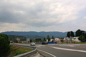
Wind turbines have been built on top of the Serra de la Fatarella ridge.