
Country United States County Woodbury FIPS code 19-71625 Elevation 333 m Zip code 51054 Local time Wednesday 9:19 PM | Time zone Central (CST) (UTC-6) GNIS feature ID 0461507 Area 5.46 km² Population 4,326 (2013) Area code 712 | |
 | ||
Weather 5°C, Wind E at 34 km/h, 86% Humidity | ||
Atw classroom viewpoints sergeant bluff iowa school on animal abuse
Sergeant Bluff is a city in Woodbury County, Iowa, United States. It is part of the Sioux City, IA–NE–SD Metropolitan Statistical Area. The population was 4,227 at the 2010 census.
Contents
- Atw classroom viewpoints sergeant bluff iowa school on animal abuse
- Map of Sergeant Bluff IA USA
- Atw classroom viewpoints sergeant bluff iowa school on children in beauty pageants
- History
- Geography
- 2010 census
- 2000 census
- Industry
- Education
- Transportation
- References
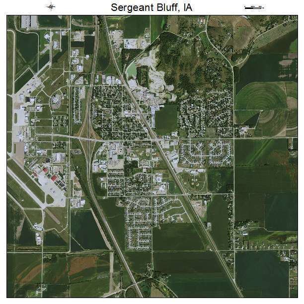
Map of Sergeant Bluff, IA, USA
Atw classroom viewpoints sergeant bluff iowa school on children in beauty pageants
History
The city was named after Sergeant Charles Floyd, the only member of the Lewis and Clark Expedition to die on the journey. Sergeant Bluff was incorporated on May 2, 1904.
Geography
Sergeant Bluff is located at 42°24′7″N 96°21′30″W (42.402055, -96.358316).
According to the United States Census Bureau, the city has a total area of 2.11 square miles (5.46 km2), all of it land.
The city is located just south of Sioux City at the edge of the Loess Hills. The Sioux City Municipal Airport (SUX) is adjacent to Sergeant Bluff, on the floodplain of the Missouri River. The city is home to a large brickmaking industry, and is near the Port Neal industrial complex. Interstate 29 cuts through the city, dividing residential and industrial areas.
2010 census
As of the census of 2010, there were 4,227 people, 1,464 households, and 1,142 families residing in the city. The population density was 2,003.3 inhabitants per square mile (773.5/km2). There were 1,499 housing units at an average density of 710.4 per square mile (274.3/km2). The racial makeup of the city was 93.1% White, 1.1% African American, 0.8% Native American, 2.1% Asian, 1.0% from other races, and 1.9% from two or more races. Hispanic or Latino of any race were 3.3% of the population.
There were 1,464 households of which 45.8% had children under the age of 18 living with them, 61.0% were married couples living together, 11.3% had a female householder with no husband present, 5.7% had a male householder with no wife present, and 22.0% were non-families. 17.7% of all households were made up of individuals and 7.3% had someone living alone who was 65 years of age or older. The average household size was 2.88 and the average family size was 3.25.
The median age in the city was 35.5 years. 32.1% of residents were under the age of 18; 6.7% were between the ages of 18 and 24; 26.3% were from 25 to 44; 25.4% were from 45 to 64; and 9.3% were 65 years of age or older. The gender makeup of the city was 48.9% male and 51.1% female.
2000 census
As of the census of 2000, there were 3,321 people, 1,137 households, and 891 families residing in the city. The population density was 1,668.7 people per square mile (644.3/km²). There were 1,176 housing units at an average density of 590.9 per square mile (228.2/km²). The racial makeup of the city was 94.49% White, 0.90% African American, 0.72% Native American, 1.78% Asian, 0.72% from other races, and 1.39% from two or more races. Hispanic or Latino of any race were 1.90% of the population.
There were 1,137 households out of which 49.5% had children under the age of 18 living with them, 61.5% were married couples living together, 13.2% had a female householder with no husband present, and 21.6% were non-families. 17.9% of all households were made up of individuals and 5.4% had someone living alone who was 65 years of age or older. The average household size was 2.91 and the average family size was 3.27.
Age spread: 33.5% under the age of 18, 8.9% from 18 to 24, 31.0% from 25 to 44, 19.5% from 45 to 64, and 7.1% who were 65 years of age or older. The median age was 31 years. For every 100 females there were 97.8 males. For every 100 females age 18 and over, there were 90.6 males.
The median income for a household in the city was $46,630, and the median income for a family was $53,344. Males had a median income of $35,771 versus $25,685 for females. The per capita income for the city was $19,320. About 4.4% of families and 5.5% of the population were below the poverty line, including 5.8% of those under age 18 and 6.6% of those age 65 or over.
Industry
Much of Sioux City's industry is located on the downstream side of Sergeant Bluff. This includes two large coal-burning power plants, an ammonia fertilizer plant, and a soybean processor. All of these are in the sprawling Port Neal Landing industrial park, which is surrounded by cornfields and the Missouri River. The terrain here is very flat, because it used to be in the river's flood plain.
The 185th Air Refueling Wing (ARW) of the Iowa Air National Guard operates KC-135R Stratotankers out of Sioux Gateway Airport (SUX), which is located just west of Sergeant Bluff. No on-base lodging is provided by the 185th, however, lodging in Sergeant Bluff includes an Econo Lodge and a Motel 6.
Education
The Sergeant Bluff-Luton School District and its four schools — primary, elementary, middle, and high — serve the children of Sergeant Bluff.
Transportation
Nearest long distance coach service is at the bus terminal in Sioux City. Jefferson Lines provides service to destinations such as Omaha.
The nearest Amtrak train station is located in Omaha.
The nearest airport is the Sioux Gateway Airport, which is located across the overpass over Interstate 29.