
Topo map USGS Half Dome Elevation 2,145 m Age of rock Cretaceous | Mountain type Granite Mountain range Sierra Nevada Parent range Sierra Nevada | |
 | ||
Location Yosemite National Park, Mariposa County, California, U.S. First ascent June 30 - July 4, 1950, by Allen Steck and John Salathé Easiest route Circular Staircase (class 5.8) Similar Middle Cathedral Rock, North Dome, Sentinel Dome, Clouds Rest, El Capitan | ||
For the granite dome near Glacier Point, Yosemite National Park, see Sentinel Dome.
Contents
Map of Sentinel Rock, California 95389, USA
Sentinel Rock is a granitic peak in Yosemite National Park, California, United States. It towers over Yosemite Valley, opposite Yosemite Falls. Sentinel Rock lies 0.7 miles (1.1 km) northwest of Sentinel Dome.
How it was formedEdit
Sentinel Rock formed when masses of rock split off Yosemite Valley's south-side cliff, along steep joints trending nearly east-west. This formed the near-vertical north face of Sentinel Rock.
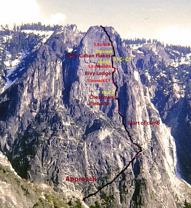
ClimbingEdit
The most famous climbing route is the Steck-Salathé route, which is rated a class 5.10b G A0.
Climber Derek Hersey died while attempting to free solo climb Sentinel Rock in 1993.
References
Sentinel Rock Wikipedia(Text) CC BY-SA