
Elevation 2,299 m Mountain range Sierra Nevada Parent range Sierra Nevada | Prominence 43 m | |
 | ||
Easiest route Trail hike from the north, class 1 Similar Clouds Rest, Sentinel Dome, Half Dome, Mount Hoffmann, Basket Dome | ||
Yosemite national park in 4k bushcraft backpacking hiking and camping at north dome upper falls
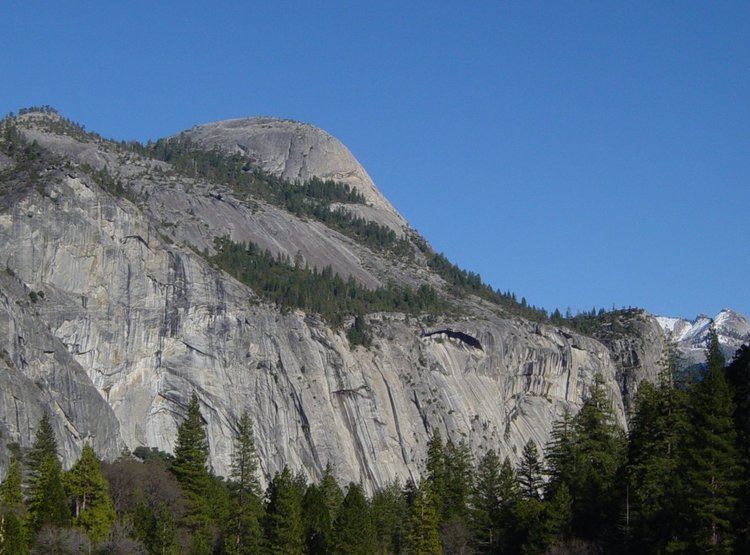
North Dome is a granite dome in Yosemite National Park, California. It is the southernmost summit of Indian Ridge, 0.6 miles (1.0 km) north of Washington Column and the Royal Arches on the northeastern wall of Yosemite Valley. It can be reached by trail from the Tioga Pass Road, or by going up the Yosemite Falls trail and heading east. It can also be reached from Mirror Lakes by the Snow Creek Falls trail going north around Indian Rock and then south again on the Tioga Pass Road trail. The South Face is precipitous.
Contents
- Yosemite national park in 4k bushcraft backpacking hiking and camping at north dome upper falls
- Map of North Dome California USA
- Yosemite ca north dome
- References
Map of North Dome, California, USA
Yosemite ca north dome
References
North Dome Wikipedia(Text) CC BY-SA