
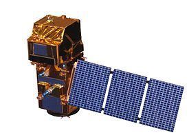
Bus AstroBus-L Start date June 23, 2015 | Spacecraft type Satellite Constellation 2 | |
 | ||
Manufacturer Airbus Defence and SpaceBoostecJena-OptronikSENER Applications Land and sea monitoring, natural disasters mapping, sea ice observations, ships detection | ||
Sentinel 2 an introduction
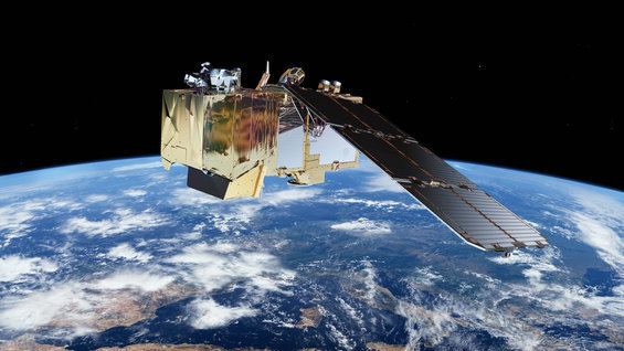
Sentinel-2 is an Earth observation mission developed by ESA as part of the Copernicus Programme to perform terrestrial observations in support of services such as forest monitoring, land cover changes detection, and natural disaster management. It consists of two identical satellites, Sentinel-2A and Sentinel-2B.
Contents
Moving ahead with sentinel 2
Overview
The Sentinel-2 mission has the following capabilities:
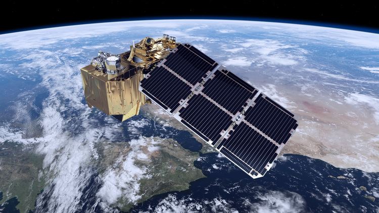
To achieve frequent revisits and high mission availability, two identical Sentinel-2 satellites (Sentinel-2A and Sentinel-2B) are planned to operate simultaneously. The planned orbit is Sun synchronous at 786 km (488 mi) altitude, 14.3 revolutions per day, with a 10:30 a.m. descending node. This local time was selected as a compromise between minimizing cloud cover and ensuring suitable Sun illumination. It is close to the Landsat local time and matches SPOT's, allowing the combination of Sentinel-2 data with historical images to build long-term time series.
Launch
The two satellites will work on opposite sides of the orbit. The launch of the first satellite, Sentinel-2A, occurred 23 June 2015 at 01:52 UTC on a Vega launch vehicle. Sentinel-2B was launched on 7 March 2017 at 01:49 UTC, also aboard a Vega rocket.
Instruments
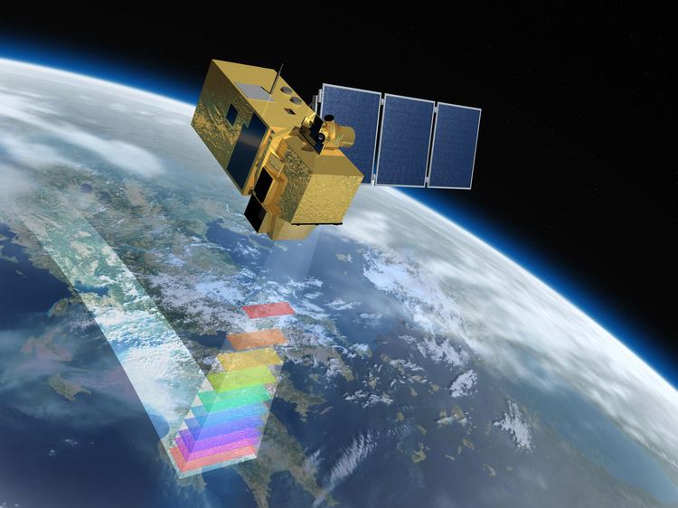
The Sentinel-2 satellites will each carry a single multi-spectral instrument (MSI) with 13 spectral channels in the visible/near infrared (VNIR) and short wave infrared spectral range (SWIR).
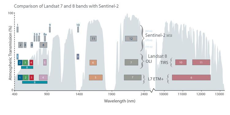
This MSI imager uses a push-broom concept and its design has been driven by the large 290 km (180 mi) swath requirements, together with the high geometrical and spectral performance required of the measurements. It has a 150 mm (6 in) aperture and a three-mirror anastigmat design with a focal length of about 600 mm (24 in); the instantaneous field of view is about 21 degrees by 3.5 degrees. The mirrors are rectangular and made of silicon carbide, a similar technology to those on the Gaia mission.
Applications
Sentinel-2 will serve a wide range of applications related to Earth's land surface and coastal zones.
The mission will mainly provide information for agricultural and forestry practices and for helping manage food security. Satellite images will be used to determine various plant indices such as leaf area chlorophyll and water content indexes. This is particularly important for effective yield prediction and applications related to Earth’s vegetation.
As well as monitoring plant growth, Sentinel-2 can be used to map changes in land cover and to monitor the world's forests. It will also provide information on pollution in lakes and coastal waters. Images of floods, volcanic eruptions and landslides contribute to disaster mapping and help humanitarian relief efforts.
Examples for applications include:
The Sentinel Monitoring web application offers an easy way to observe and analyse land changes based on archived Sentinel-2 data.
Products
Sentinel-2's multi-spectral imager undertakes systematic acquisition in a single observation mode.
Training data sets
In June 2013, the Centre National d'Etudes Spatiales (CNES) released and distributed training data sets acquired by the SPOT 4 satellite with the same repetitivity as planned for Sentinel-2, to help future Sentinel-2 users develop methods and applications based on multitemporal data. This experiment, named SPOT4 (Take5), was held between February and June 2013, and provided time series over 45 sites for a variety of applications. To obtain this data set, the orbital altitude of SPOT4 was decreased by 2 kilometres (1.2 mi) in order to place it in a 5-day revisit cycle.
This experiment was repeated with the SPOT 5 satellite, thanks to a co-funding from ESA and CNES, between April and September 2015. On this second experiment, 150 sites scattered all over the world have been observed.
The data from both experiments are freely available from the Spot (Take5) experiment site.