
Time zone CET/CEST (UTC+1/+2) Area 19.13 km² Postal code 02782 Dialling code 03586 | Elevation 360 m (1,180 ft) Postal codes 02782 Population 4,371 (31 Dec 2008) Local time Sunday 7:30 PM | |
 | ||
Weather 8°C, Wind E at 8 km/h, 40% Humidity | ||
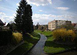
Seifhennersdorf (Upper Sorbian: Wodowe Hendrichecy) is a town in the district Görlitz, in the Free State of Saxony, Germany. It is situated on the border with the Czech Republic, and the Czech towns of Rumburk and Varnsdorf lie across the border to the north-east and south of town.
Contents
Map of 02782 Seifhennersdorf, Germany
Seifhennersdorf is 8 km south of Ebersbach and 14 km west of Zittau.
History
During World War II, a subcamp of Flossenbürg concentration camp was located in the town.
References
Seifhennersdorf Wikipedia(Text) CC BY-SA