OS grid reference ST931610 Local time Sunday 3:09 PM UK parliament constituency Devizes | Sovereign state United Kingdom Postcode district SN12 Dialling code 01380 | |
 | ||
Weather 17°C, Wind E at 24 km/h, 51% Humidity | ||
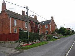
Seend Cleeve is a large hamlet or sub-village immediately west of Seend in Wiltshire, England. It lies about 2.3 miles (3.7 km) southeast of the town of Melksham.
Map of Seend Cleeve, Melksham, UK
A Primitive Methodist chapel and Sunday school were founded in Seend Cleeve. In 1849, the chapel was rebuilt in red brick with ashlar quoins. The chapel closed in 1979 and was converted into a private house in 2012.
Seend Cleeve Quarry was a source of brown haematite. Since 1987 the quarry has been a Geological Site of Special Scientific Interest.
Seend Cleeve has two public houses: the Barge Inn on the Kennet and Avon Canal, and the Brewery Inn.
References
Seend Cleeve Wikipedia(Text) CC BY-SA
