
Height 130m | ||
 | ||
Owner Hebden Royd CouncilFarmers / Landowners | ||
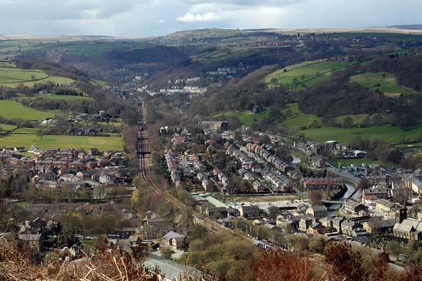
Scout Rock is a cliff on the south side of the Upper Calder Valley in the village of Mytholmroyd in Hebden Bridge, England. At its height, the cliff rises 130m above the village and the exposed rock face is visible from as far as Chiserley and Luddendenfoot. The majority of the rock face is now covered in vegetation. Hathershelf Forest is situated at the base of the cliff, and a large beacon stands around half way up the hill on the western side of the cliff face.
Contents
Events
Due to the Boxing Day floods of 2015 that affected the Upper Calder Valley, a large landslide occurred at the base of the cliff, and uncovered a large asbestos disposal site, the site is now covered in an encasing whilst work is undertaken to secure the site. The landslide also affected the 'Scout Road' row of houses at its base and the 'Scout Road Academy' school, also at the base of Scout Rock which had to be evacuated and re-located along with around 20 other homes.
Culture
Scout Rock can be seen from the majority of the village of Mytholmroyd, and is usually instantly associated with it. During the hours of darkness, the cliff provides an almost pitch black backdrop to the village. Ted Hughes home was across the valley from the cliff, and was the view from Hughes' window which "provided both the curtain and back-drop to existence" where Hughes' was "fascinated" by it, and symbols or references to Scout Rock in some of Hughes' work.