
Surface area 80 acres (32 ha) Surface elevation 2,048 m Mean depth 3.05 m | Average depth 10 ft (3.0 m) Area 32 ha | |
 | ||
Similar Show Low Lake, Fool Hollow Lake, Clear Creek Reservoir, Rainbow Lake, Becker Lake | ||
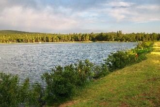
Built in 1928, Scott Reservoir is an irrigation impoundment on Porter Creek near Pinetop-Lakeside, Arizona. The least developed of the "in town" lakes, trees surround Scott Reservoir. It lies just outside the town limits on the Apache-Sitgreaves National Forests.
Contents
Map of Scott Reservoir, Arizona 85929, USA
DescriptionEdit
Scott Reservoir covers 80 acres (32 ha) with an average depth of 10 feet (3.0 m), and lies at 6,720 feet (2,050 m) altitude. It is usually somewhat turbid, which helps control algae blooms and aquatic weeds. This, coupled with a perennial stream flowing in, creates a stable water quality condition. The lake is stocked with catchable-sized rainbow trout in spring, early summer and fall, and it is occasionally stocked with channel catfish. There are also some largemouth bass.
Fish speciesEdit
References
Scott Reservoir Wikipedia(Text) CC BY-SA