
Reference no. AT: 2-8-127 Basin area 11.7 km² | ||
 | ||
Main source below the Reither Spitze1,346 m (AA) River mouth in Zirl into the Inn592 m (AA) | ||
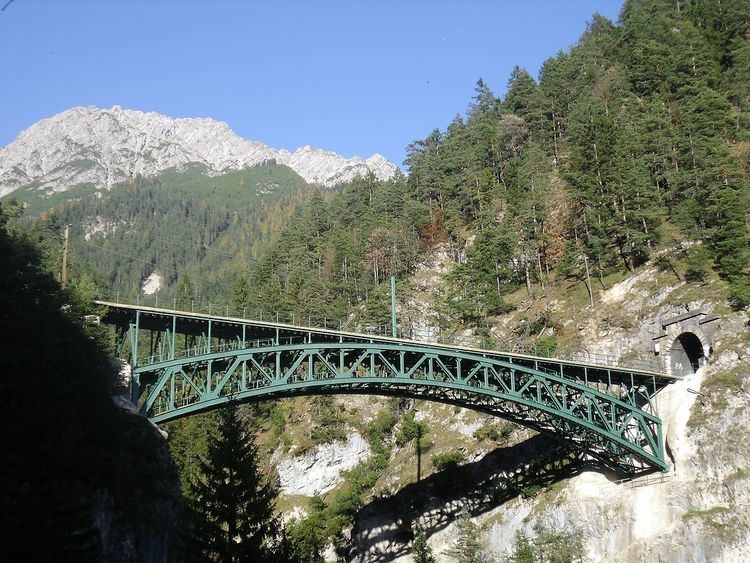
The Schlossbach is a left tributary of the River Inn in the Austrian state of Tyrol that discharges into the Inn at Zirl. It rises below the Reither Spitze in the municipality of Reith bei Seefeld and flows in a north to south direction. After around 1.5 km it collects the Grieskarbach from the left. In its upper reaches is a gorge, the Schlossbachklamm (location: 47.297059°N 11.238778°E / 47.297059; 11.238778). This is traversed at a height of 60 metres by the Schlossbach Bridge which carries the track of the Mittenwald Railway. The railway bridge is a 66-metre-long, trussed arch structure made of steel that is a popular photograph subject.
Map of Schlo%C3%9Fbach, Austria
After emerging from the narrow gorge into the Inn valley, the Schlossbach flows through Zirl and empties into the Inn southwest of the village. Together with the Ehnbach further east it has pushed the Inn southwards and piled up the alluvial fan on which Zirl has been built.