
Time zone CET/CEST (UTC+1/+2) Area 83.03 km² Population 8,824 (31 Dec 2008) | Elevation 432 m (1,417 ft) Postal codes 07901–07907 Local time Friday 8:52 AM Dialling code 03663 | |
 | ||
Weather 4°C, Wind NE at 16 km/h, 92% Humidity | ||
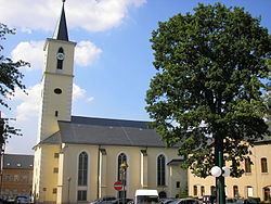
Schleiz is a town in the district of Saale-Orla-Kreis in Thuringia, Germany.
Contents
- Map of 07907 Schleiz Germany
- Location
- Neighboring parishes
- Subdivisions
- History
- 20th Century
- Population
- Recreation
- References
Map of 07907 Schleiz, Germany
Location
Schleiz is in the Thuringian Vogtland area, an area of wooded hills on the borders of Thuringia, Saxony, Bavaria and the Czech Republic. The city is located in a valley with the river Wisenta near the motorway A 9 (Berlin – München).
Neighboring parishes
Distances calculated as between town centers.
Subdivisions
Schleiz includes the following subdivisions:
History
Schleiz can be traced back to a settlement established about 1200 ("Altstadt") and a separate "Neustadt" that was established next to it. The "Neustadt" had a castle and a city wall. Until 2 December 1482 they were totally separate communities after which they combined to one city. There was a settlement of the Teutonic Order here, and for some years previous to 1848 the town was the capital of the small principality of Reuss-Schleiz. In the vicinity a battle was fought, between the French and the Prussians on 9 October 1806.
Within the German Empire (1871-1918), Schleiz was part of the Principality of Reuss-Gera.
20th Century
During World War 2 hundreds of women and men from several nations, including the Soviet Union were transported to Schleiz as forced laborers. At least 60 of them died there.
The palace was destroyed April 1945.
Population
Trend of population figures:
Recreation
Schleiz is also the site of the Schleizer Triangle motor racing track.