
Isolation 30.3 km (18.8 mi) Elevation 2,964 m Prominence 826 m | First ascent 24 August 1610 Easiest route Hiking | |
 | ||
Similar Sulzfluh, Zimba, Drusenfluh, Panüelerkopf, Piz Kesch | ||
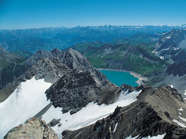
The Schesaplana is the highest mountain in the Rätikon mountain range at the border between Vorarlberg, Austria and Graubuenden, Switzerland. It has an elevation of 2,964.3 m (9,725 ft).
Map of Schesaplana
On the north side of the Schesaplana is a glacier called Brandner Gletscher. To the east is the Lünersee.
It is possible to reach the summit on various routes during a hike, making it useful for a multiday trek between the mountain huts in the area. A more horizontal trek is following the whole of the Rätikon chain along its southern face, called "Prättigauer Höhenweg".
References
Schesaplana Wikipedia(Text) CC BY-SA