
Admin. region Arnsberg Time zone CET/CEST (UTC+1/+2) Population 11,174 (30 Jun 2010) Postal code 58579 | Area 38.2 km² Local time Friday 3:10 AM Administrative region Arnsberg | |
 | ||
Elevation 183 - 502 m (−1,464 ft) Weather 3°C, Wind NE at 11 km/h, 93% Humidity | ||
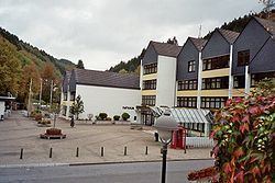
Schalksmühle is a municipality in district Märkischer Kreis, in North Rhine-Westphalia, Germany. It is the town with the highest rate of millionaires relating to the population in North Rhine-Westphalia(2004).
Contents
Map of Schalksm%C3%BChle, Germany
Geography
Schalksmühle is located in the hills of the Sauerland, and the altitude of the 38.2 km² area varies between 183 m (Pulvermühle) and 502 m (east of Sonnenscheid) above sea level. 45% of the area is covered by forest, another 35% is used for agricultural purposes. The main river is the Volme, a tributary of the Ruhr.
History
The oldest written documents on the municipality date back to 1350, when the farmers of Hülscheid formed a free duchy. The largest extent of the Freigrafschaft Hülscheid was in 1478, when it contained not only the Kirchspiel Hülscheid, but also the northwestern part of the Kirchspiel Lüdenscheid.
Schalksmühle itself was first mentioned on May 1, 1407 in a document by archbishop Friedrich of Cologne, when Gerwin of Altenbreckerfeld, a merchant, donated an altar to the church of Breckerfeld. One of the villages leased by Gerwin was Schalksmollen in parrochia Halvere (Schalksmühle in the parish Halver).
The municipality in its modern boundaries was created during the communal reforms of 1969/70. Becoming effective on January 1, 1969 the municipality Schalksmühle was merged with the municipality Hülscheid (previously in the Amt Lüdenscheid). On January 1, 1970 the municipality Dahlerbrück (previously in the Amt Breckerfeld, district Ennepe-Ruhr) was also added to it.
Coat of arms
The coat of arms combined the symbols of the two municipalities merged in 1969. The top part shows the upper half of a black mill wheel (Mühle is German for mill), the symbol for Schalksmühle. In the bottom are three leaves of European Holly (Ilex aquifolium), which was taken from the coat of arms of the municipality Hülscheid. As no traditional symbols were found for Hülscheid a "talking symbol" was chosen - Hülsebusch is one of several traditional German names of the Ilex. The two symbols are separated by a red-and-white chequered bordure as the symbol of the counts of the Mark. The coat of arms was granted on July 21, 1970.
Before 1969 the coat of arms of the municipality was very similar to the current one, except that the bottom part of the shield was a simple golden field. That coat of arms was granted on March 29, 1935. The coat of arms of the municipality of Hülscheid had the Ilex leaves instead of the mill wheel in top. That coat of arms was granted on January 16, 1935. Both were designed by Otto Hupp, based on an idea of Fritz Thomée, former Landrat of the district Altena.
Twin towns
Schalksmühle is twinned with two towns. Since July 1987 it has had a partnership with Ruhla in Thuringia (at that time in East Germany). Since 1970 it has had a partnership with the English district of Wansbeck in Northumberland. This originated when a young man (Klaus Floeren) from Iserlohn worked for some time in the town of Bedlington and met his future wife (Muriel Binks) there.
After moving to Schalksmühle with their young son Rolf, the couple suggested a partnership between the two communities. When Bedlington town council was merged with Ashington and Newbiggin-by-the-Sea to form the district of Wansbeck, the partnership was continued by the new district council.