
Elevation 440 m (1,440 ft) Postal codes 99842 Area 38.51 km² Population 6,355 (31 Dec 2008) | Time zone CET/CEST (UTC+1/+2) Dialling codes 036929 Local time Friday 3:05 PM Postal code 99842 Dialling code 036929 | |
 | ||
Weather 8°C, Wind NE at 23 km/h, 66% Humidity | ||
Ruhla is a town situated in the forest of Thuringia in the district of Wartburgkreis in Germany, immediately next to the Rennsteig. Thal and Kittelsthal are parts of the town. It lies on Carl-Gareis-Straße 16.
Contents
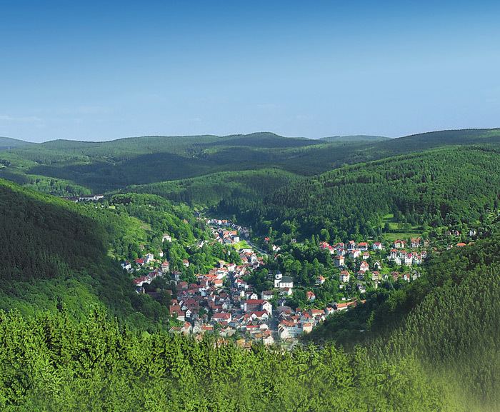
Map of Ruhla, Germany
History
Within the German Empire (1871-1918), part of Ruhla belonged to the Grand Duchy of Saxe-Weimar-Eisenach and part to the Duchy of Saxe-Coburg and Gotha.
Church of St. Concordia
The church was built in 1660-61 and has never been changed since then. It is one of about eight angle churches in Germany and is considered to be among the two "real" angle churches, i.e. it was originally built as an angle church whereas the other churches only became angle churches after some reconstruction. The church consists of two wings that are situated at a right angle. Where the two wings meet there is the spire and the altar space from where both wings can be overlooked. Since Ruhla was largely spared from destruction during World War I and II, St Concordia was not affected either. Hence it is the only angle church that has been conserved unaltered and in its original state since its first construction.
mini-a-thür
The park mini-a-thür (derived from miniature) shows about 90 models of sights of Thuringia, among the Creuzburg, Erfurt Hauptbahnhof, the Planetarium Jena and the Wartburg.
It was the birthplace of the composer Friedrich Lux. One of his operas is called The Blacksmith of Ruhla.