
MPP Brad DuguidLiberal First contested 1963 Population (2011) 111,911 Elector 71,094 | District created 1963 Last contested 2014 | |
 | ||
Legislature Legislative Assembly of Ontario | ||
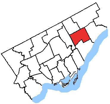
Scarborough Centre is a provincial electoral district in Ontario, Canada, that has been represented in Legislative Assembly of Ontario since 1963.
It consists of the part of the Scarborough district of the City of Toronto bounded:
Notable landmarks in Scarborough Centre include:
It has been represented in the Ontario Legislature by Liberal Brad Duguid since 2003.
Scarborough Centre is a bellwether riding, having voted for the winner in every election since 1971 (longer than any other provincial riding). However, it did comprise different territories, changing shape significantly between the 1995 and 1999 elections.
Boundaries
The riding was created in 1963 through an amendment to the Representation Act. It was formed from the south central part of the former riding of York—Scarborough. The riding was bordered by Lawrence Avenue to the north, Kennedy Road to the west, Lake Ontario to the south and Markham Road to the east.
In 1975, the boundary was significantly altered. The northern boundary of Lawrence Avenue and the southern boundary of Lake Ontario were retained. The western boundary was redrawn as follows: from Lawrence Avenue, it followed the CNR right-of-way located west of Midland Avenue south and then curved southeast to where it met Midland Avenue at Danforth Road. It followed Midland Avenue south to Kingston Road where it turned southwest following Kingston to a point where a northerly extension of Wynnview Court would meet the road. It then turned south along Wynnview Court and continued on the same line south until it met the lake. The eastern boundary started at Lawrence Avenue and went south on Scarborough Golf Club Road following this road to the CNR right-of-way. It followed the tracks west to Markham Road and then south to the lake.
In 1987 the boundary was altered again. The northern boundary of Lawrence Avenue and the southern boundary of Lake Ontario were retained. The eastern boundary starting at the lake went north along Kennedy Road to Eglinton Avenue. It then turned east for a short distance to the CPR right-of-way. It followed the right-of-way north to Lawrence Avenue. The eastern border was moved to Markham Road going from the lake to Lawrence Avenue.