
Legislature House of Commons District created 1987 Last contested 2015 Province Ontario Elector 68,748 | MP Arnold Chan
Liberal First contested 1988 District webpage profile, map Census division Toronto | |
 | ||
Restaurants Perfect Chinese Restaurant, Gourmet Malaysia Restaurant, The Roti Hut, Congee Me, One2Sna | ||
Scarborough—Agincourt is a federal electoral district in Toronto, Ontario, Canada that has been represented in the House of Commons of Canada since 1988.
Contents
- Map of Agincourt Toronto ON Canada
- Geography
- Demographics
- History
- Members of Parliament
- Municipal electoral districts and neighbourhoods
- Wards
- Neighbourhoods
- Community and Resident Associations
- References
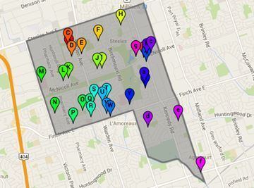
Map of Agincourt, Toronto, ON, Canada
Geography
The riding covers the northwest of the Scarborough part of Toronto. It is bounded on the west by Victoria Park Avenue, on the north by the Toronto city limits (Steeles Avenue East), on the east by Midland Avenue, and on the south by Highway 401. It contains the neighbourhoods of Steeles, L'Amoreaux, Tam O'Shanter-Sullivan, Agincourt (west of Midland Avenue) and Milliken (west of Midland Avenue).
Demographics
Immigrants make up 67.8% of the population of Scarborough—Agincourt, the highest such percentage for any Canadian federal riding; those from Asia and the Middle East alone, constitute a majority of the population (53.0%), which is also the highest figure for any federal riding, and, in particular, immigrants from the People's Republic of China are almost a quarter (24.7%) of the riding's population, another Canadian high. Chinese, not otherwise specified (i.e. Cantonese, Mandarin, etc.) is the home language for 12.0% of the people in Scarborough—Agincourt (another demographic record).
According to the Canada 2011 Census; 2013 representationEthnic groups: 46.0% Chinese, 20.8% White, 15.1% South Asian, 5.3% Black, 3.8% Filipino, 1.9% West Asian, 1.6% Arab
Languages: 41.3% Chinese, 32.5% English, 5.1% Tamil, 2.3% Tagalog, 1.8% Armenian, 1.7% Arabic, 1.6% Greek, 1.6% Arabic, 1.4% Italian, 1.4% Urdu, 1.2% Persian
Religions: 42.7% Christian (18.0% Catholic, 5.3% Christian Orthodox, 2.3% Anglican, 2.0% Baptist, 1.7% United Church, 1.5% Pentecostal, 1.0% Presbyterian, 10.9% Other Christian), 7.9% Hindu, 6.5% Muslim, 5.6% Buddhist, 36.5% No religion
Median income (2010): $20,702
Average income (2010): $29,076
History
The federal riding was created in 1987 from York—Scarborough. It consisted in initially of the part of the City of Scarborough bounded on the west by Victoria Park Avenue, on the north by Steeles Avenue East, on the east by the Canadian National Railway line situated immediately west of Midland Avenue, and on the south by Ellesmere Road.
In 2003, it was given the boundaries as described above.
A by-election was held on June 30, 2014 as a result of the resignation of Member of Parliament Jim Karygiannis to run for City Councillor in the 2014 Toronto municipal election.
Following the 2012 federal electoral boundaries redistribution, the riding lost the part of the riding east of Midland Avenue to the new riding of Scarborough North.
Members of Parliament
This riding has elected the following members of the House of Commons of Canada:
Municipal electoral districts and neighbourhoods
Scarborough—Agincourt covers three wards and six neighbourhoods.
Wards
Three wards fall completely or partially within the borders of Scarborough—Agincourt.
Neighbourhoods
Three neighbourhoods fall completely within the borders of Scarborough—Agincourt:
The west ends of three neighbourhoods also fall within the borders of Scarborough—Agincourt:
In addition to these there are other neighbourhoods such as Wishing Well, Lynngate and Bridlewwod, etc.
Community and Resident Associations
- Bridlewood
- Leacock Community Association
- Lynngate Residents' Association & Neighbourhood Watch
- Neighbourhood Watch
- SAS Scarborough Association of Seniors
- The Scarborough-Agincourt Ward 40 Residents' Association