
Year built 1895 | Phone +1 705-941-6262 | |
 | ||
Address 1 Canal Dr, Sault Ste. Marie, ON P6A 6W4, Canada Similar OLG Casino Sault Ste, Canadian Bushplane Heritage, Art Gallery of Algoma, Essar Centre, Ermatinger/Clergue Heritage Site | ||
Sault ste marie canal national historic site of canada
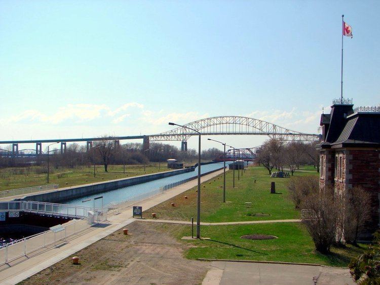
The Sault Ste. Marie Canal is a National Historic Site of Canada in Sault Ste. Marie, Ontario. Until 1987, the canal was part of the shipping route from the Atlantic Ocean to Lake Superior. It includes a lock to bypass the rapids on the St. Marys River.
Contents
- Sault ste marie canal national historic site of canada
- Sault ste marie canal national historic site
- References
The first lock was built in 1798 by the Northwest Trading Company. On July 20, 1814 an American force destroyed the North West Company depot on the north shore of the St. Marys River. Since the Americans were unable to capture Fort Michilimackinac, the British forces retained control of the Sault. The lock was destroyed in 1814 in an attack by U.S. forces during the War of 1812.
In 1870, the United States refused the steamer Chicora, carrying Colonel Garnet Wolseley permission to pass through the locks at Sault Ste Marie. The Wolseley Expedition incident led to the construction of a Canadian Sault Ste. Marie Canal, which was completed in 1895.
The construction of the canal and lock was completed in 1895. At that time it was the largest lock and first electrically operated lock in the world. The canal is about 1.6 kilometres (1 mi) long and originally the lock portion was 274 metres (899 ft) long and 18 metres (59 ft) wide.
On June 9, 1909 the locks were seriously damaged when the Perry G. Walker, owned by the Gilchrist Transportation Co. of Cleveland, Ohio, crashed into the south main gate, forcing it back and allowing the force of water to push the north main gate over. The rush of water threw the Perry G. Walker back and carried two other ships downstream, one of which struck the south main gate, breaking it diagonally in two. The rush of water through the destroyed locks was stopped by activation of the Emergency Swing Dam, allowing repairs to commence. Amazingly, there was no loss of life or injury associated with this disaster, and repairs required only 12 days, with the bridge reopening on June 21, 1909.
Due to a wall failure in 1987, the historic lock was shut down indefinitely. A new lock, built within the old lock, was opened in 1998 and is 77 metres (253 ft) long, 15.4 metres (51 ft) wide, 13.5 metres (44 ft) deep, with a 3 metres (9.8 ft) draft. The canal is used for recreational and tour boats; major shipping traffic uses the U.S. locks.
There are several heritage buildings on the site: the administration building, the superintendent's residence, the canalmen's shelter, the powerhouse and the blacksmith shop, all constructed from red sandstone dug up during the canal's construction. Most of the original machinery used to operate the lock is also still in place. Another unique feature of the site is the Sault Canal Emergency Swing Dam, the only emergency swing dam left in existence, and the only one to ever be used in an emergency.
Guided tours are available in the summer only. The visitor centre is open year round.