
Area 8.81 km² Local time Thursday 2:55 AM | Region Normandy Canton Valmont Time zone CET (UTC+1) Population 957 (1999) | |
 | ||
Weather 6°C, Wind E at 5 km/h, 89% Humidity | ||
Sassetot-le-Mauconduit is a commune in the Seine-Maritime department in the Haute-Normandie region in northern France.
Contents
Map of 76540 Sassetot-le-Mauconduit, France
Geography
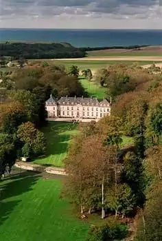
A farming village, by the coast of the English Channel, in the Pays de Caux, situated some 34 miles (55 km) northeast of Le Havre, at the junction of the D5 and D79 roads. The commune is sandwiched between two ‘’vallons’’, short valleys that create a gap in the huge cliffs, giving access to the sea via the pebble beach. The name comes from the Norman "Sax-Tot", meaning ‘’village of the Saxons". Mauconduit was the name of the 13th century seigneurs.
Places of interest
References
Sassetot-le-Mauconduit Wikipedia(Text) CC BY-SA