
Length 518.4 km | ||
 | ||
North end: Hwy 55 at Beaver House near Choiceland Ruralmunicipalities: Surprise Valley, The Gap, Norton, Caledonia, Bratt's Lake, Lumsden, Longlaketon, Cupar, Kutawa, Mount Hope, Prairie Rose, Spalding, Star City, Kinistino, Pleasantdale, Willow Creek, Nipawin, Torch River | ||
Highway 6 is a paved undivided major provincial highway in the Canadian province of Saskatchewan. It runs from Montana Highway 16 at the Canada–US border near the Canada customs port of Regway to Highway 55 near Choiceland. Highway 6 is about 516.6 km (321.0 mi) long. The CanAm Highway comprises Saskatchewan Highways from south to north: SK 35, Sk 39, Sk 6, Sk 3, as well as Sk 2. 203.1 miles (326.9 km) of Saskatchewan Highway 6 contribute to the CanAm Highway between Corinne and Melfort.
Contents
- Map of SK 6 Saskatchewan Canada
- Canada United States border to Corinne
- Highway 6 section of CanAm Highway begins
- Highway 6 section of CanAmHighway ends
- History
- Major intersections
- Extra reading
- References
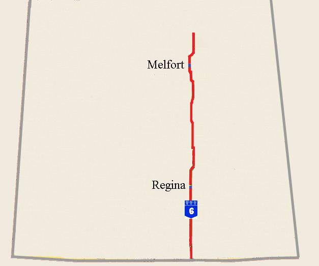
Map of SK-6, Saskatchewan, Canada
Major provincial highways that Highway 6 intersects are Highway 18, Highway 13 (the Redcoat Trail), Highway 39, Highway 1 (The Trans-Canada), Highway 11, Highway 99, Highway 22, Highway 15, Highway 16 (the Yellowhead), Highway 5, Highway 3, Highway 41, and Highway 55.
Highway 6 passes through the cities of Regina and Melfort.
Canada - United States border to Corinne
Highway 6 begins at the Canada–United States border. The border crossings are Raymond, Montana on Montana Highway 16 in the United States and at Regway, Saskatchewan on Hwy 6. Two early name choices for Meyer were Meyersville or Fort Comfort the name of the neighboring North-West Mounted Police (NWMP) post to the north. Minton, became a hamlet in 1930 and in 1951 Minton incorporated as a village. The initial stages of the journey are mixed grassland, and the main economy is ranching. This area traversed is the Big Muddy Badlands area of the Missouri Coteau. The terrain of the Missouri Coteau features low hummocky, undulating, rolling hills, potholes, and grasslands. This physiographic region of Saskatchewan is the uplands Missouri Coteau, a part of the Great Plains Province or Alberta Plateau Region which extends across the south east corner of the province of Saskatchewan. There are several unique geographical features. The Big Muddy Valley, The Hole in the Wall Coulee, Roan Mare Coulee are all deep valleys of the area. The Big Muddy Lake, an alkali lake, could be crossed at the Diamond Crossing was a rise in Big Muddy Lake. Outlaw gangs such as the Jones-Nelson Gang used this undulating landscape to cross the border and hide out. The Big Muddy Lake itself is as are West Coteau and East Coteau lake. Between the Canada customs port of Regway, and Minton are several points of interest such as an old schoolhouse, and the historic Ceylon Park Memorial Garden. Gibson Creek is dammed with Ceylon Dam providing water to the village of Ceylon, as well as the Ceylon Regional Park which is located just off Hwy 6. Besides passing ranches, oil and gas wells, agricultural lands producing feed, there are also Pregnant Mare Urine barns along this route. Hwy 6 intersects the Red Coat Trail near Pangman at Ceylon.
Highway 6 section of CanAm Highway begins
Corinne is located at the Sk Hwy 6 and Sk Hwy 39 junction.
It is here that the northern journey of the CanAm Highway continues on Sk Hwy 6. Sk Hwy 6 and Sk Hwy 1, the TransCanada Hwy Cloverleaf interchange south of Regina is one of the first two Saskatchewan interchanges which opened in 1967. Regina is the capital of Saskatchewan and is the second largest in the province (after Saskatoon). Regina was previously the headquarters of the North-West Territories, of which today's provinces of Saskatchewan and Alberta originally formed part, and of the District of Assiniboia.
The city is situated on a broad, flat, treeless plain. There is an abundance of parks and greenspaces: all of its trees – some 300,000 – shrubs and other plants were hand-planted and Regina's considerable beauty is entirely man-made. As in other prairie cities, American elms were planted in front yards in residential neighbourhoods and on boulevards along major traffic arteries and are the dominant species in the urban forest. The IPSCO Wildlife Park is located off Hwy 6 at Regina. The Qu'Appelle River flows east–west across the province, Highway 6 goes through the Qu'Appelle valley north of Regina. A crosswalk was installed at Southey, with overhead lights giving higher visibility to pedestrians crossing Hwy 6 at Assiniboia Avenue.
In the Aspen Parkland ecoregion, deer and other large ungulates are a hazard to traffic, resulting in potential animal or human deaths, especially in the autumn mating months or when deer are searching for feeding grounds in the spring. The defense mechanism of deer in the face of a threat is to freeze. There are over 3,500 deer–auto collisions per year in Saskatchewan. A number of measures have been implemented to increase awareness such as fencing, feeding programs, automobile whistles. Deer mirrors along the edges of highways were installed for reducing deer-vehicle collisions. The Wildlife Warning System is triggered by highway vehicles, setting off lights, sounds and or odours ahead of the approaching vehicle to frighten away animals. A system that detects vehicle was installed in 2002 near Harris to reduce the quantity of mule deer–automobile accidents for a two-year testing period. Another system detects large animals and sets off a warning system to drivers of vehicles, alerting them that an animal is on or near the highway ahead of time.
The projects on Highways 39 and 6 will help to improve traffic flow through these Canada/U.S. ports. "Highways 6 and 39 are very important to Saskatchewan – serving as tourism links and major north-south trade corridors to the U.S.," Sonntag said.
At the Hwy 39 concurrency, Hwy 6 becomes a part of the CanAm Highway. The historic Wood Mountain - FortQu'Appelle Trail is marked with a point of interest marker. McNab Regional Park is located south of Watson featuring pool and golf course. Watson is located amid the junction of Hwy 5 and Hwy 6. In this area Hwy 6 is traveling through the boreal-transition ecoregion.
Highway 6 is a major north/south highway that has been experiencing higher volumes of truck traffic and general traffic, ... By strengthening the base of this section, we are ensuring Highway 6 will be able to support these heavier loads.
The highway travels east of Lake Charron upon which Lake Charron Regional Park offers camping, fishing, nature trails and snowmobiling trails. Naicam is served by Hwy 6, and Hwy 349. This area is sustained by agriculture, with the ecosystem changing from the rolling parkland to boreal forest. The Barrier river valley, Kipabiskau Regional Park, and Lake Charron Regional Park are nearby features.
Highway No. 6 has a much higher traffic count, many more trucks in and out from the States than Highway No. 35 would have.’’
Highway 6 section of CanAmHighway ends
Melfort, a city of about 6,000, is located on Hwy 6, Hwy 3, and Sk Hwy 41. The CanAm Highway continues north on Hwy 3.
The South Saskatchewan and North Saskatchewan Rivers join together west of the highway. The highway thus crosses the Saskatchewan River. The Fort à la Corne Provincial Park and the confluence of the Saskatchewan River Basin are two major attractions in this area. Choiceland is located 1 mile (1.6 km) north of Hwy 55, the terminus junction of Hwy 6. The rural municipality of Torch River No. 488 is located past the tree line of Saskatchewan. There are several recreational sites in the area such as Scot's Landing on the Saskatchewan River and Carrolls Cove Campground, Pruden's Point at Tobin Lake.
History
In 1999 the asphalt concrete pavement section of Highway 6 north of Raymore was tested with a Cold in-place recycling or “CIR” method to rehabilitate highways. This CIR process is a cost-effective method which recycles the top surface of a road. This pulverized material is mixed with asphalt emulsion and spread and compacted back onto the highway surface. This surface is then recovered with a new seal dependent on traffic volume.
Major intersections
From south to north: