
South end Hwy 8 / Glenmore Trail Length 8,900 m | North end 34 Avenue NW | |
 | ||
Majorjunctions Richmond Road17 Avenue SWBow Trail 16 Avenue NW | ||
Sarcee trail sw calgary ab time lapse
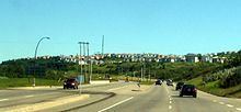
Sarcee Trail is a major super-4 expressway and trunk road in Calgary, Alberta. It is divided into two portions, one in the south end of the city, and one in the north end of the city. Originally planned as one continuous route, plans to connect the two halves have been shelved as it would involve the demolition of home in Bowness. The urban arterial road is named for the Tsuu T'ina, who were also known as the Sarcee.
Contents
- Sarcee trail sw calgary ab time lapse
- Sarcee trail place 71 glamis drive sw calgary ab
- Sarcee Trail SW
- Major intersections
- Sarcee Trail NW
- References
Sarcee trail place 71 glamis drive sw calgary ab
Sarcee Trail SW
The southern half of Sarcee Trail acts as a major connector between Glenmore Trail to the south and 16 Avenue NW in the west end of the city, though the road continues north into the community of Bowness at 34 Avenue NW. Sarcee Trail is signed as bypass route which connects Highway 1 west and Highway 2 south. Sarcee Trail crosses the divide between the southwest and northwest quadrants of the city at 16 Avenue NW.
Major intersections
From south to north. The entire route is in Calgary.
Sarcee Trail NW
The northern half of Sarcee Trail travels between the communities of Silver Springs in the south and Nolan Hill in the north. It starts at the intersection of Crowchild Trail and Silver Springs Gate, a short road formerly part of Sarcee Trail, that connects to the Silver Springs community. Heading northbound, Sarcee Trail continues along until it hits 144 Avenue NW, acting as the divider between several communities along the way.
Major intersections
From south to north. The entire route is in Calgary.