
Elevation 181 m (594 ft) Time zone CET (UTC+1) Dialling code 0771 | Province / Metropolitan city Latina (LT) Demonym(s) Sancosemesi Area 31 km² Local time Wednesday 6:14 AM Postal code 04020 | |
 | ||
Frazioni Cerri Aprano, Grunuovo, San Lorenzo, Ventosa Weather 9°C, Wind NE at 6 km/h, 99% Humidity | ||
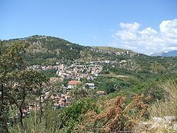
Santi Cosma e Damiano is a town and comune in the province of Latina, in the Lazio region of central Italy, whose territory is located partly in the Monti Aurunci area and partly in the Garigliano plain.
Contents
Map of 04020 Santi Cosma e Damiano, Province of Latina, Italy
Sights include an 11th-century tower in the frazione of Ventosa.
History
It is mentioned for the first time in a Gaetan document from 830 AD, although the area was inhabited in ancient times by the Ausoni/Aurunci (nearby was the ancient town of Vescia).
Here, in the locality known as Vattaglia (local dialect for "battle"), was fought in 915 the Battle of Garigliano between the Italian league and the Saracens. After the battle the place was part of the Duchy of Gaeta, then of the Montecassino Abbey until the Norman conquest in 1140, after which it followed the history of the Kingdom of Naples.
During World War II, Santi Cosma e Damiano was located on the Gustav Line, and therefore suffered heavy bombings in 1943–44.