
Country Venezuela Time zone UTC-04:30 Elevation 900 m Local time Tuesday 7:31 PM | Region Guayana Founded November 13, 1923 Postal Code 8052 Population 29,795 (2006) Number of airports 1 | |
 | ||
Weather 22°C, Wind E at 8 km/h, 90% Humidity | ||
Santa Elena de Uairén ([ˈsanta eˈlena ðe waiˈɾen]) is a small Venezuelan city (29,795 inhabitants in 2006) in the state of Bolívar near the border with Brazil and Guyana. It was Founded by Lucas Fernandez Peña in 1923. The city's name originates from the first daughter of Lucas Fernandez Pena Elena, and Uairén by the river that crosses the city.
Contents
Map of Santa Elena de Uairen, Bol%C3%ADvar, Venezuela
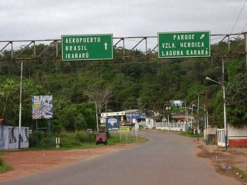
Located in the middle of La Gran Sabana (Great Plains), Santa Elena is home to many travel agencies offering tours in Canaima National Park, flights over Angel Falls, and hiking tours to the famous Monte Roraima.
The town is notable for its influential presence of indigenous peoples; there is even a community called Manakrü (pronounced mah-nah-CREE) populated entirely by indigenous people. The schools in this neighborhood use both Spanish and Pemon, an indigenous language.
Due to its proximity to the Brazilian state of Roraima, Santa Elena sees a busy exchange between the two countries of Brazilian consumer products from Brazil and Venezuelan oil. Other Brazilian cities that trade with Santa Elena de Uairen are Manaus, Santarém, Macapá, Belém.
History
Santa Elena was founded in 1923 by Lucas Fernández Peña, attracted by diamond's mines found there. In 1999, a free zone was declared in the city, due to its proximity to Brazil, the city is crowded of Brazilians during the weekends seeking low prices (food, electronics, hygiene products...)