
Country United States Time zone CST (UTC-6) Elevation 189 m Local time Tuesday 9:34 AM | Established November 6, 1923 ZIP codes 62618, 62627, 62691 Area 103.1 km² Population 328 (2010) | |
 | ||
Weather 8°C, Wind NE at 18 km/h, 71% Humidity | ||
Sangamon Valley Township is one of eleven townships in Cass County, Illinois, USA. As of the 2010 census, its population was 328 and it contained 191 housing units.
Contents
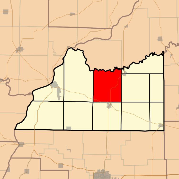
- Map of Sangamon Valley Township IL USA
- Geography
- Cities towns villages
- Unincorporated towns
- Cemeteries
- Major highways
- Rivers
- Lakes
- Landmarks
- School districts
- Political districts
- References
Map of Sangamon Valley Township, IL, USA
Geography
According to the 2010 census, the township has a total area of 39.81 square miles (103.1 km2), of which 39.71 square miles (102.8 km2) (or 99.75%) is land and 0.1 square miles (0.26 km2) (or 0.25%) is water.
Cities, towns, villages
Unincorporated towns
(This list is based on USGS data and may include former settlements.)
Cemeteries
The township contains these three cemeteries: Cauby, Powell and Walnut Ridge.
Major highways
Rivers
Lakes
Landmarks
School districts
Political districts
References
Sangamon Valley Township, Cass County, Illinois Wikipedia(Text) CC BY-SA