
Area 5.86 sq mi (15.2 km) OS grid reference TL175105 Local time Tuesday 11:41 AM UK parliament constituency Hitchin and Harpenden | Population 11,451 (2011) Civil parish Sandridge | |
 | ||
Weather 9°C, Wind SW at 29 km/h, 52% Humidity | ||
St albans sky noise pollution luton airport aircraft noise ruining st albans sandridge
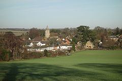
Sandridge is a village and civil parish between St Albans and Wheathampstead in Hertfordshire, England.
Contents
- St albans sky noise pollution luton airport aircraft noise ruining st albans sandridge
- Map of Sandridge St Albans UK
- History
- The Second Battle of St Albans
- Information
- References
Map of Sandridge, St Albans, UK
History
The original name was "Saundruage" meaning a place of sandy soil serviced by bond tenants.
The earliest recorded mention of Sandridge is in the year 796 the parish being part of the revenue of the Mercian Kings. It was given by Egfrith son of Offa in the first year of his reign to abbot Eadric second abbot of St Alban's Monastery and to the monks of St Albans.
Part of the parish of Sandridge was added to the Municipal Borough of St Albans in 1887. The remainder of the parish was renamed Sandridge Rural in 1894 when Sandridge Rural Parish Council was formed. In 1913 a further 241 acres were transferred to St Albans. The parish name reverted to Sandridge in 1957.
The Second Battle of St Albans
In February 1461 the final skirmishes of the Second Battle of St Albans took place in and around Sandridge as the Earl of Warwick, for the Yorkists, retreated towards Nomansland.
Information
The population of Sandridge ward at the time of the 2001 census was 4,808. This includes some people living in the Jersey Farm area of St Albans.
The village has three pubs: The Green Man, The Rose and Crown and The Queen's Head.
The village church is St Leonard's and dates back to 1114.
It also supports Sandridge Rovers F.C., who play in the Hertfordshire Senior County League.
Sandridge was one of the earlier homes of the great English general, John Churchill, 1st Duke of Marlborough, and his infamous wife, Sarah, a favourite of Queen Anne. The title Baron Sandridge was given to Churchill by James II in 1685, and was his first English peerage title (his earlier title, Baron Eyemouth, had been created in 1682 by James's predecessor, Charles II, in the Peerage of Scotland).
In 1939 the first WW2 secret Wireless Intercept Station was constructed by the GPO at the top of Woodcock Hill. It was the first of a group of stations dedicated to Diplomatic Interception with rows of radio operators listening to the wireless traffic between Germany, Italy, Tokyo and other enemy embassies around the world. Messages intercepted at Sandridge were sent to Bletchley Park for decryption. The results were vital to Winston Churchill who used the information to make important decisions about the course of the war. After WW2 it became part of the Diplomatic Wireless Service under GCHQ and in 1973 the site was taken over by The Home Office for Police research.
In 2008 the Woodland Trust announced plans to create a new forest north of Sandridge. The 347 hectares (860 acres) of woodland are to be called Heartwood Forest.