
OS grid reference ST9364 Local time Tuesday 11:42 AM UK parliament constituency Chippenham | Sovereign state United Kingdom Postcode district SN12 Dialling code 01225 | |
 | ||
Weather 9°C, Wind W at 26 km/h, 58% Humidity | ||
Sandridge is a dispersed rural community to the east of Melksham, Wiltshire, England. It is part of the civil parish of Melksham Without.
Map of Sandridge, Melksham, UK
An Ordnance Survey map of 1961 names a settlement at Sandridge Hill, 2.5 miles (4.0 km) east of Melksham, and a hamlet of Sandridge, 0.25 miles (0.4 km) to the north; as of 2015 these names are no longer in gazetteers and Sandridge refers to a wider area along the A3102, with Sandridge Common identified on road signs near Melksham.
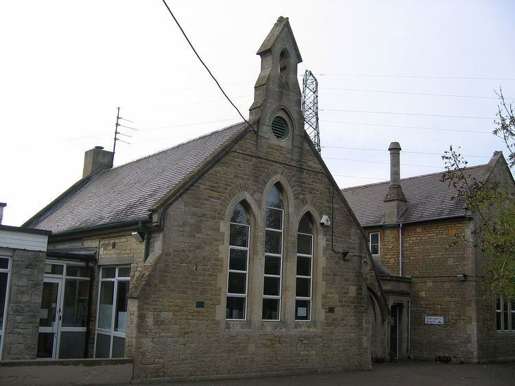
A National School was built in 1873 at Sandridge Common, and educated children of all ages until 1953; around that time it became known as Forest and Sandridge Church of England Primary School. In 2015, to cater for the eastward expansion of Melksham, the school moved to a new building on the outskirts of the town.