
Established 1947 Postal code 241 Population 388,230 (Aug 2016) Area code 02 | Time zone CST (UTC+8) Area 16.32 km² Local time Tuesday 3:20 PM | |
 | ||
Website www.sanchong.ntpc.gov.tw Weather 18°C, Wind NE at 18 km/h, 77% Humidity Points of interest Xingfushuiyang Park, 三重先啬宫 Xianse Temple, Danshuihepan Park, Sanchonghuanbao Park, Taiyang Park | ||
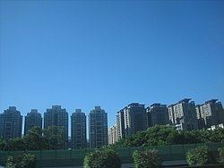
Sanchong District (Chinese: 三重區; pinyin: Sānchóng Qū; Pe̍h-ōe-jī: Sam-tiông-khu) is an inner city district in the western part of New Taipei City, Taiwan. With an area of 16.32 km² and a population of 384,618 people (2003), it has the fourth highest population density in Taiwan and 23rd in the world, with over 23,900 people per km².
Contents
- Map of Sanchong District New Taipei City Taiwan 241
- Geography
- History
- Republic of China
- Demography
- Education
- Tourist attractions
- Shopping and eating
- Transportation
- References
Map of Sanchong District, New Taipei City, Taiwan 241
Geography
Sanchong is bounded to the north and northwest by Luzhou, Wugu, the west by Xinzhuang, and is separated from Taipei City by Tamsui River.
History
Sanchong was called Satengpo (Chinese: 三重埔; Pe̍h-ōe-jī: Saⁿ-têng-po͘ / Sam-tiông-po͘), which literally means "The Third Plain" by the early settlers. The settlers from the modern-day Xinzhuang area moved up north and named the plains they settle as "The First Plain" (頭前埔, located in modern-day Xinzhuang District), "The Second Plain" (二重埔, located in modern-day Sanchong) and The Third Plain.
Republic of China
The district has been an important suburb of Taipei. On 1 April 1962, Sanchong was upgraded from an urban township to be a county-controlled city. On 25 December 2010 with the creation of New Taipei City from former Taipei County, Sanchong City was upgraded into a district.
Demography
As of October 2015, there were 388,550 people living in the district.
The 2010 Population Census reported that Sanchong has a population of 390,904. The population density was 24,172.6 inhabitants per square kilometer.
Education
Tourist attractions
Shopping and eating
Transportation
The district is served by the Taipei Metro Luzhou Line (Line 4) at Sanchong Elementary School and Sanhe Junior High School, as well as Xinzhuang Line at Taipei Bridge, Cailiao, Sanchong, and Xianse Temple stations. The future Taoyuan Airport MRT will have a stop at Sanchong station.
By road, the district is accessible by National Highway No. 1, Provincial Highway No. 1 and No.1A, and Provincial Highway No. 64. The district is connected to Taipei City via Chongyang Bridge, Taipei Bridge, Zhongxiao Bridge, and Zhongxing Bridge. It is also connected to Xinzhuang, Luzhou, Wugu, and Banqiao.