
Time zone +8 Population 82,983 (Jan 2016) | Area 34.86 km² | |
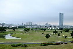 | ||
Wugu District (Chinese: 五股區; pinyin: Wǔgǔ Qū; Pe̍h-ōe-jī: Gō͘-kó͘-khu) is a suburban district in the western part of New Taipei City in northern Taiwan. It has an area of 34.86 km² and a population of 82,255 people (2014).
Contents
- Map of Wugu District New Taipei City Taiwan 248
- History
- Tourist attractions
- Transportation
- Notable natives
- References
Map of Wugu District, New Taipei City, Taiwan 248
History
In the 19th century the area was known as Go-ko-khi (Chinese: 五穀坑; Pe̍h-ōe-jī: Ngó͘-kok-khiⁿ; also 五股坑; Gō͘-kó͘-khiⁿ). Until the 25 December 2010 creation of New Taipei, Wugu was a rural township (Chinese: 五股鄉; pinyin: Wǔgǔ Xiāng; Pe̍h-ōe-jī: Gō͘-kó͘-hiong; Postal: Wuku) in the former Taipei County.
Notorious Kuomintang general Chen Yi was interred in Wugu following his execution.
Tourist attractions
Transportation
Wugu is served by the Zhongshan Freeway (National Highway No. 1) and Provincial Highway No. 64 expressway.
Notable natives
References
Wugu District Wikipedia(Text) CC BY-SA