
 | ||
Similar Mount Matutum, Mount Melibengoy, Robinsons Place General, Mount Apo | ||
Leaving sanchez peak general santos city philippines
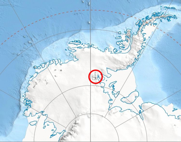
Sanchez Peak is a 2,800 metres (9,200 ft) high peak on the ridge that extends eastward to Mount Osborne in southern Sentinel Range of the Ellsworth Mountains, Antarctica. It was named by the Advisory Committee on Antarctic Names (US-ACAN) in 2006 after Richard D. Sanchez of U.S. Geological Survey, a senior physical scientist and specialist in remote sensing, image analysis and the use of GPS and GIS with respect to Antarctic mapping applications.
Contents
- Leaving sanchez peak general santos city philippines
- Map of Sanchez Peak General Santos City South Cotabato Philippines
- Sanchez peak sumit view
- Location
- Maps
- References
Map of Sanchez Peak, General Santos City, South Cotabato, Philippines
Sanchez peak sumit view
Location
Sanchez Peak is located at 78°38′S 85°00′W, which is 2.5 miles (4.0 km) east of Mount Craddock and 1.16 miles (1.87 km) west of Stolnik Peak. US mapping in 1961, updated in 1988.
Maps
References
Sanchez Peak Wikipedia(Text) CC BY-SA