
Basin countries United States | Catchment area 75 sq mi (190 km) | |
 | ||
Primary inflows Primary outflows San Vicente Creek, San Vicente Pipelines 1 and 2 | ||
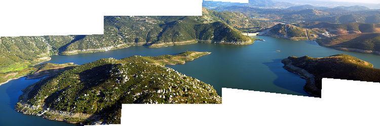
San Vicente Reservoir is a reservoir created by the San Vicente Dam in San Diego County, California. It is located in the Cuyamaca Mountains, approximately 4.3 miles (6.9 km) north of Lakeside off California State Route 67.
Contents
Map of San Vicente Reservoir, California, USA
DescriptionEdit
The reservoir is formed by impounding the waters of San Vicente Creek, and the Colorado River via the First San Diego Aqueduct branch of the Colorado River Aqueduct from Lake Havasu. It is the largest reservoir in the city of San Diego.
In 2009, construction began of a $568 million project to increase the size of San Vicente Reservoir twofold. San Diego County Water Authority officials are hoping to receive funding from Proposition 18 (the $11.1 billion bond to upgrade the Californian water supply), but will continue the upgrade without these funds if the Proposition is unsuccessful. [1]
RecreationEdit
On August 24th 2016, it was announced the Reservoir would reopen to the public on September the 22nd, 2016. The Reservoir had been closed since September 1st, 2008. The raising of the dam more than doubled the reservoir's past capacity of 145,200,000 cu yd (111,000,000 m3) by increasing it 245,226,666 cu yd (187,489,239 m3) to a total of 390,426,666 cu yd (298,502,604 m3).