
 | ||
Refugio del quetzal san rafael pie de la cuesta san marcos
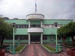
San Rafael Pie de la Cuesta ([san rafaˈel pje ðe la ˈkwesta]) is a municipality in the San Marcos department of Guatemala.
Contents
- Refugio del quetzal san rafael pie de la cuesta san marcos
- Map of San Rafael Pie de la Cuesta Guatemala
- Climate
- Geographic location
- References
Map of San Rafael Pie de la Cuesta, Guatemala
A small town with red tiled roofs and abundant flowering trees in the northern department of San Marcos, Guatemala, a department which borders Mexico. Although part of San Marcos is "cold country", the term used by Guatemalans to refer to the highlands which, while not cold, are certainly not as warm as the coastal plain, San Rafael Pie de la Cuesta is warmer than the rest of the department. As its name implies, San Rafael Pie de la Cuesta lies at the base of the Sierra Madre mountain range. There are many coffee plantations in the area.
Climate
San Rafael Pie de la Cuesta has tropical climate (Köppen: Am).
Geographic location
Located 27 km west of San Marcos and is surrounded by San Marcos Department municipalities.