
Basin area 1,243 km² | ||
 | ||
The San Pitch River, extending 65 miles (105 km), is the primary water course of the Sanpete Valley and drains into the Sevier River in southwestern Sanpete. The river is named for the Ute chief Sanpitch, who also gives his name to the San Pitch Mountains and Sanpete County.
Contents
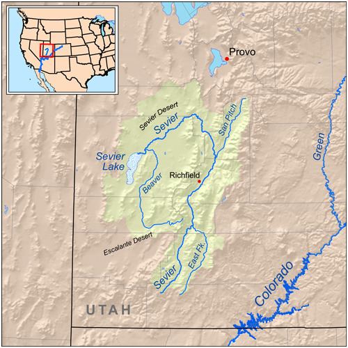
Map of San Pitch River, Utah, USA
CourseEdit
The upper San Pitch River begins north of Milburn, Utah near Oak Creek Ridge on the Northern Wasatch Plateau and flows south to Moroni. The middle San Pitch River runs from Moroni where it crosses State highway 132. The middle San Pitch River runs from U132 to Gunnison Reservoir. The lower San Pitch River flows from Gunnison Reservoir to where it meets the Sevier River, west of Gunnison, Utah.
References
San Pitch River Wikipedia(Text) CC BY-SA