
Area 22.96 km² Population 476 (2005) | Local time Monday 9:09 PM | |
 | ||
Time zone Central Standard Time (UTC-6) Weather 13°C, Wind NE at 6 km/h, 84% Humidity | ||
San Pablo Guelatao is a town and the seat of the Municipality of Guelatao de Juárez, in the Mexican state of Oaxaca. It is part of the Ixtlán District in the Sierra Norte de Oaxaca region.
Contents
Map of San Pablo Guelatao, Oaxaca, Mexico
Guelatao, as it is often called, is in the foothills of the Sierra de Juárez, a mountain range in the Sierra Madre de Oaxaca System. It is about 55 km north of the city of Oaxaca
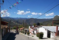
The town
It is the birthplace of President Benito Juárez. At that time, Guelatao had a population of fewer than 100 people, and fell under the jurisdiction of the larger neighbouring town of Ixtlán. Juárez was therefore baptised in the church at Ixtlán, which is now known as Ixtlán de Juárez in his honour. However, Guelatao became an independent municipality in 1824. The town has a small museum dedicated to Juárez.
XEGLO, a government-run indigenous community radio station that broadcasts in Zapotec, Mixe and Chinantec, is based in Guelatao.
Demographics
In 2005 San Pablo Guelatao had 111 households with a population of about 476 people.
The majority of the population are indigenous Zapotec.
The municipality
The Municipality of Guelatao de Juárez has governing jurisdiction over the communities of Llano de la Cheta and Río Grande. It is part of the Ixtlán District.
San Pablo Guelatao is the seat of the municipality.