
Established 1947 Area 129.9 km² Local time Sunday 12:51 AM | District 1st District Barangays Population 16,628 (2010) Area code 72 | |
 | ||
Weather 27°C, Wind S at 6 km/h, 74% Humidity | ||
Tangadan falls san gabriel la union
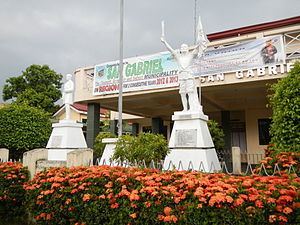
San Gabriel (Ilocano: Ili ti San Gabriel) is the largest municipality by land area in the province of La Union in the Philippines. One of the landlocked towns of the province, San Gabriel is bounded on the north by Santol with an imaginary line from a point in Ticor following the Malanas River; on the east by the Province of Benguet with an imaginary line from the Bacawayan River Junction going south following a creek to Cabassitan River up to Barangay Duplas of San Juan, southwest by San Juan with an imaginary line from Duplas following the Cabassitan River westward to a point on a concrete monument near the place known as Alangigan and from this monument going north-west making an imaginary line to Sitio Bato crossing the Dayacos River, and on the west by Bacnotan from Sitio Bato to a point in Lacong, from this point going straight with an imaginary line to Ticor, North of Sitio Matagectec, Barangay Lacong.
Contents
- Tangadan falls san gabriel la union
- Map of San Gabriel La Union Philippines
- Barangays
- History
- Economy
- References
Map of San Gabriel, La Union, Philippines
Barangays
San Gabriel is politically subdivided into 15 barangays.
History
San Gabriel was formerly known as sitio “Baka-Burnotan”, derived from “binnornutan” (English: "tug-of-war"). The sitio was the meeting place of both Christians and pagan Kankanaey settlers from nearby sitios to graze their cattle while playing the game. The name was later shortened to "burnotan". The wide plain and fertile soil attracted Christian and pagan settlers, who later intermarried which led to the increase in population.
On April 19, 1897, a Roman Catholic priest Father Redondo established a church in the area and introduced the patron saint to be Saint Gabriel, from which the town was later named.
In 1906, San Gabriel was made into a township under the sub-province of Amburayan in Mountain Province, with the first Presidente being Don Pablo Waggay. The township was converted into a municipal district of Amburayan in 1920, and into a municipality in 1922, following the settlement of a boundary dispute between La Union and Mountain Province. In 1947, San Gabriel was converted into a regular municipality by virtue of Executive Order No. 72 issued by President Manuel Roxas through the sponsorship of former House Speaker Pro-Tempore Francisco Ortega.
Economy
San Gabriel is an agricultural town. In its early days, the people of San Gabriel were engaged mainly in highland farming as their means of livelihood. They produced rice, corn, sweet potatoes and other root crops. As years passed, crop production decreased due to massive soil erosion in the uplands. Nevertheless, the inhabitants decided to improve their farming techniques and started making terraces. The perseverance of the people in constructing rice terraces and irrigation system along the hills and mountains of San Gabriel caused agricultural productivity to rebound.
Bananas and tiger grass ("Thysanolaena maxina") are also abundant in San Gabriel, which harvests materials for soft broom production on a weekly basis.