
Length 193 km Countries France, Belgium | Main source Picardy199 m (653 ft) Source elevation 199 m Mouth Meuse | |
 | ||
Basin size 2,740 square kilometres (1,060 sq mi) Similar Meuse, Namur Citadel, Leie, Ourthe, Haine | ||
The Sambre is a river in northern France and in Wallonia, Belgium. It is a left tributary of the Meuse.
Contents
Map of Sambre
Course
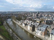
The source of the Sambre is near Le Nouvion-en-Thiérache, in the Aisne department. It passes through the Franco-Belgian coal basin, formerly an important industrial district. Its Belgian portion was at the western end of the sillon industriel, which was Wallonia's industrial backbone. It is canalized along much of its length and flows into the Meuse at Namur, Belgium. The Sambre is connected with the Oise by the Sambre-Oise Canal.
The Sambre flows through the following departments of France, provinces of Belgium and towns:
Events
Battles
The 19th-century theory that the Sambre was the location of Julius Caesar's battle against a Belgic confederation (57 BC), was discarded a long time ago, but is still repeated.
Heavy fighting occurred along the river during World War I, especially at the siege of Namur in 1914 (Battle of Charleroi) and in the last month of the war (Battle of the Sambre (1918)).