
- elevation 1,306 ft (398 m) Architectural style Rustic Phone +1 573-856-4411 | Built 1933 (1933) Area 19.67 km² Established 1926 | |
 | ||
MPS ECW Architecture in Missouri State Parks 1933-1942 TR Address Rt. 1, Patterson, MO 63956, USA Similar Greenville Campgro, US Army Corps of Engineers, Bearcat Getaway, Amidon Memorial Conserva, Pinewoods Lake Campgro | ||
Hd drone footage from sam a baker state park shut ins area missouri
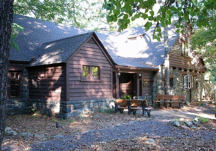
Sam A. Baker State Park is a state-owned, public recreation area encompassing 5,323 acres (2,154 ha) in the Saint Francois Mountains region of the Missouri Ozarks. The state park was acquired in 1926 and is named for Missouri governor Sam Aaron Baker who encouraged the development of the park in his home county. In the 1930s, the Civilian Conservation Corps added many structures to the park including the park office and visitors center, which was originally used as a stable, the stone dining lodge, most of the park's cabins, and the backpacking shelters on the Mudlick Trail. Twenty-five buildings and five structures comprise the Sam A. Baker State Park Historic District, a national historic district listed on the National Register of Historic Places in 1985.
Contents
- Hd drone footage from sam a baker state park shut ins area missouri
- Sam a baker state park june 27 july 1 2014
- Activities and amenitiesEdit
- References