
Country United States Incorporated March 2, 1867 Area 5.4 km² Local time Friday 7:59 PM Area code 606 | Established 1860 Elevation 260 m Zip code 41465 Population 1,839 (2013) | |
 | ||
Named for the Kentucky state representative who sponsored the establishment of Magoffin Co. Weather 12°C, Wind W at 10 km/h, 82% Humidity | ||
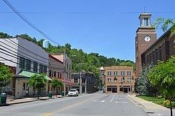
Salyersville (/sæljərzvəl/ or /sɑːjərzvəl/) is a home rule-class city on the Licking River in Magoffin County, Kentucky, in the United States. It is the seat of its county. During the 2010 U.S. Census, its population was 1,883.
Contents
- Map of Salyersville KY 41465 USA
- Early history
- 20th century
- 21st century
- Geography
- Climate
- Demographics
- Economy
- Cultural events and fairs
- Museums
- Monuments
- Historical markers
- Parks
- Education
- Media
- Notable people
- References
Map of Salyersville, KY 41465, USA
Early history
After an aborted attempt at settlement in 1794, the hill overlooking the Horseshoe Bend of the Licking River just downriver from the present city was fortified and settled c. 1800 by Archibald Prater, Ebenezer Hanna, and others. Originally known as Prater's Fort, the community had become Licking Station by the time of its first post office in 1839.
In 1849, the post office was moved to the community at site of the present city and renamed Adamsville after local landowner William "Uncle Billy" Adams. In addition to his farmland, Adams operated a hotel, a gristmill, a tannery and a blacksmith at the new location.
In 1860, Magoffin Co. was formed from parts of the surrounding Floyd, Johnson, and Morgan counties. Billy Adams donated land for the platting and establishment of a new county seat and the community was renamed "Salyersville" in gratitude to State Rep. Samuel Salyer, who sponsored the bill creating the new county. The post office changed the following year.
During the Civil War, Salyersville fell on hard times. Because of its location in the Upper South and its history of settlement by migrants from Virginia, some residents sided with the Confederacy despite the general lack of slaves in the area. In 1864, Union forces defeated a Confederate raiding force in the Battle of Salyersville.
Adams gave more land to the city in 1871 for the construction of a proper courthouse. It was completed in 1890 and stood for 67 years before burning to the ground in 1957.
20th century
Salyersville's first high school, the Magoffin County Institute, was founded in 1908 by A.C. Harlowe.
The Great Depression hit Salyersville hard, since such a high percentage of Salyersville's citizens were laborers or farmers, who saw prices for crops fall from 40 to 60%. Nearby mining and logging operations also closed or limited production when demand for their products fell sharply. In 1939, the Licking River crested over 25 feet (7.6 m), flooding most of downtown Salyersville and causing extensive property damage.
In 1963, the Bert T. Combs Mountain Parkway is completed, stretching west 76 miles (122 km) from Salyersville to intersect with Interstate 64 at a point just east of Winchester. It enabled more tourists to visit the area, and heritage tourism began to help Salyersville develop a changed economy. The first annual Magoffin County Founder's Day Festival was held in 1978.
In the winter of 1997, as part of Kentucky's elk restoration project, Salyersville became one of the locations selected for the release of elk into the wilderness area of its mountains.
21st century
In 2002, the second Magoffin County court house (erected in 1960) was demolished. In its place, a new Justice Center was constructed, which opened in Spring 2006. The new Justice Center's architecture plays tribute to Magoffin County's original courthouse.
As of 2006, Magoffin County remains one of the poorest counties in the United States. The county is the 42nd-poorest county by per capita income and the 24th-poorest county in the nation by median household income.
On March 2, 2012, Salyersville was hit by a tornado which caused extensive damage to the business center and many homes. The tornado killed two people and was rated an EF3. This tornado was a separate storm that formed in Wolfe County, KY, and is not the tornado that previously hit West Liberty and Wellington. Kentucky Gov. Steve Beshear visited both cities on March 3 and toured the eastern part of the state after the tornado outbreak.
Geography
Salyersville is " North, 83°3'47" West (37.748171, -83.062984). According to the United States Census Bureau, the city has a total area of 2.1 square miles (5.4 km2), all land.
Climate
The climate in this area is characterized by relatively high temperatures and evenly distributed precipitation throughout the year. The Köppen Climate System describes the weather as humid subtropical, and uses the abbreviation Cfa.
Demographics
As of the census of 2000, there were 1,604 people, 646 households, and 414 families residing in the city. The population density was 758.1 people per square mile (292.1/km²). There were 710 housing units at an average density of 335.6 per square mile (129.3/km²). The racial makeup of the city was 99.69% White, 0.06% African American, and 0.25% Native American. 0.31% of the population were Hispanic or Latino of any race.
There were 646 households out of which 27.9% had children under the age of 18 living with them, 49.4% were married couples living together, 12.2% had a female householder with no husband present, and 35.9% were non-families. 33.9% of all households were made up of individuals and 14.9% had someone living alone who was 65 years of age or older. The average household size was 2.22 and the average family size was 2.85.
In the city, the population was spread out with 20.8% under the age of 18, 9.2% from 18 to 24, 26.1% from 25 to 44, 24.1% from 45 to 64, and 19.8% who were 65 years of age or older. The median age was 41 years. For every 100 females there were 88.9 males. For every 100 females age 18 and over, there were 83.1 males.
The median income for a household in the city was $16,042, and the median income for a family was $23,393. Males had a median income of $26,534 versus $20,188 for females. The per capita income for the city was $11,881. About 35.7% of families and 40.7% of the population were below the poverty line, including 56.4% of those under the age of 18 and 34.3% of those 65 and older.
Economy
Major employers included the manufacturing company Joy Mining Machinery, which closed its Salyerville plant in 2015.
Cultural events and fairs
Museums
Monuments
Historical markers
Parks
Education
Salyersville's public schools are operated by the Magoffin County Board of Education. Salyersville's Magoffin County High School mascot is the Hornets.
Other public schools in Salyersville are the Herald Whitaker Middle School, North Magoffin Elementary, Salyersville Elementary School, and South Magoffin Elementary
Media
The local weekly newspapers in Salyersville include The Salyersville Independent and the Trading Post, mostly for advertising. Founded in 1921, The Salyersville Independent circulates over 4,000 copies every Thursday. It is currently owned and published by David Prater.
Cable service in Salyersville is provided by Rick Howard Cable, Frank Howard Cable and Foothills Cooperative. Through these companies, Salyersville is provided with standard and premium cable TV service, high-speed Internet access and telephone service. Frank Howard Cable and Rick Howard Cable offer local programming via MCTV (Magoffin County Television) and MCSTV (Magoffin County School TV), a channel dedicated to local school programming. MCTV carries a daily local news media program 'Your News Today'.
Salyersville's radio stations include the local WRLV (AM/FM) Pure Country 106.5 and 1140. Stations of surrounding counties can also be heard, such as Prestonsburg's WQHY (FM) 95.5, Paintsville's WKLW (FM) 94.7, and West Liberty's Kick 102.9.