
State Kingdom of Denmark Time zone GMT Climate ET Local time Wednesday 7:43 AM | Postal code FO 436 Population 30 (1 Jan 2006) Municipality Sunda, Faroe Islands | |
 | ||
Weather 3°C, Wind E at 18 km/h, 65% Humidity | ||
Saksun summer 2014
Saksun (Danish: Saksen) is a village near the northwest coast of the Faroese island of Streymoy, in Sunda Municipality.
Contents
Map of Saksun, Faroe Islands
Saksun the faroe islands
Geography
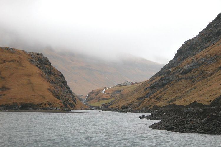
Saksun lies in the bottom of what used to be an inlet of the sea, surrounded by high mountains. The inlet formed a good deep natural harbour, until a storm blocked it with sand. The old harbour become an unaccessible seawater lagoon, only accessible by small boats on high tide.
Facilities
The village has a church and museum. The church was originally built in Tjørnuvík, but in 1858 it was disassembled, carried over the mountains and reassembled in Saksun. The Museum occupies a seventeenth century farm house called Dúvugarður. The house belongs to the Dúvugarður farm, still an active sheep farm with approximately 300 ewes.
References
Saksun Wikipedia(Text) CC BY-SA