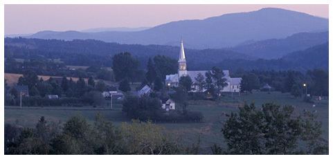
Country Canada RCM Coaticook Time zone EST (UTC−5) Area 58.6 km² Province Québec | Region Estrie Constituted June 11, 1917 Postal code(s) J0B 1S0 Population 104 (2011) Area code 819 | |
 | ||
Saint-Venant-de-Paquette is a municipality in Quebec.
Contents
- Map of Saint Venant de Paquette QC Canada
- History
- Population
- About the Village
- Les Amis du Patrimoine
- References
Map of Saint-Venant-de-Paquette, QC, Canada
History
Founded in 1862, the village of Saint-Venant-de-Paquette is nicknamed "The Turtle Dove of the Eastern Townships". This small village of a hundred people is the oldest settlement near the U.S. border.
Population
Population trend:
There are about 100 residents; however, the exact number is not available. The municipality is unable to provide an exact figure because many of the homes are used as cottages or as second homes.
About the Village
The village is situated north of East-Hereford, south of St. Malo, and east of Coaticook.
The village employs only two part-time workers: the mayor and a secretary. The only service provided is waste management, and snow removal.
Most villagers do not have access to high-speed internet.
Most villagers have wells to provide water.
The nearest fire department is in Beecher Falls, Vermont.
The church has been turned into a museum.
Les Amis du Patrimoine
Since 1993, a committee called Les Amis du Patrimoine was organized in order to promote and organize cultural and artistic activities in the village. Some of these activities have funded, in part, the maintenance and renovation of the church. Further, Les Amis du Patrimoine have added, to their list of responsibilities, the opening of a small boutique called the "Tree House", and, have created a nature-path called the "Poetic Trail". Les Amis du Patrimoine in Saint-Venant-de-Paquette is a non-profit organization that depends mainly on the voluntary involvement of its citizens and from elsewhere.
