
Canton Aiguilles Time zone CET (UTC+1) Population 267 (1999) | Area 44.75 km² Local time Wednesday 3:43 AM | |
 | ||
Weather 1°C, Wind NE at 6 km/h, 55% Humidity Points of interest Queyr'âne, Maison du Soleil, Église Saint‑Véran de Saint, Pic de Château Renard | ||
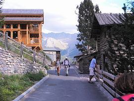
Saint-Véran is a commune in the Hautes-Alpes department in southeastern France in the Queyras Regional Natural Park.
Contents
Map of 05350 Saint-V%C3%A9ran, France
Geography
Saint-Véran, located in the French Alps is the most elevated commune in France. It is the third highest village in Europe, after Trepalle in Italy and Juf in Switzerland.
The permanent population is around 300 but swells with tourists in both summer and winter. In addition to tourism the main activities are agriculture and woodcraft.
Name
The village is named after Saint Véran, 6th century Bishop of Cavaillon who in legend drove away a dragon.
The Observatoire de Saint-Véran was constructed nearby by the Observatoire de Paris in the early 1970s.
References
Saint-Véran Wikipedia(Text) CC BY-SA