
 | ||
Similar Mount Robert, Lake Rotoiti, Lake Rotoroa, Nelson Lakes National, Rainbow Ski Area | ||
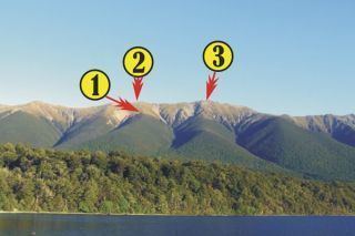
The Saint Arnaud Range is a mountain range in the central north of New Zealand's South Island. It lies between Lake Rotoiti and the upper reaches of the Wairau River, and marks the eastern boundary of Nelson Lakes National Park.
Contents
Map of Saint Arnaud Range, Rainbow 7072, New Zealand
The lower elevations are covered primarily in beech forests, while higher elevations (above about 5,000 feet) are alpine.
RecreationEdit
The St Arnaud track ascends the western side of the range from the village of Saint Arnaud (about 3 hours climb).
The Rainbow Ski Area is on the eastern side of the range.
References
Saint Arnaud Range Wikipedia(Text) CC BY-SA