
Elevation 1,421 m | ||
 | ||
Similar Mount Hutt, The Remarkables, Mount Taranaki, Roys Peak, Mount Arthur | ||
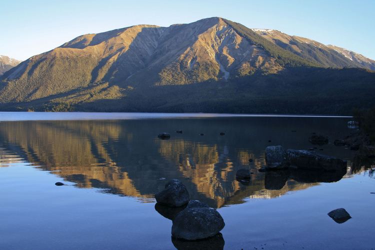
Lake angelus new zealand mount robert pinchgut track robert ridge route to angelus hut
Pourangahau / Mount Robert is a 1,421m high mountain in the Nelson area of New Zealand's South Island. It is within the Nelson Lakes National Park.
Contents
- Lake angelus new zealand mount robert pinchgut track robert ridge route to angelus hut
- Map of Mount Robert Tasman District 7072 New Zealand
- Mount roberts tramway in juneau alaska
- References
Map of Mount Robert, Tasman District 7072, New Zealand
The partially unsealed Mt Robert Road, just west of the town of Saint Arnaud leads to a car park that is the start of tramping tracks into the Nelson Lakes National Park, and also a 5-hour loop walk up the mountain: The Pinchgut Track zigzags steeply up to near the top of Mt Robert, then continues along a ridge to Bushline Hut, before descending via the more gentle Paddy's Track. The track offers view over Lake Rotoiti and St Arnaud.
The treeline on the northeastern slopes of Mt Robert is unusually low due to erosion following the loss of the original beech forest by fire in 1887 and subsequent grazing. Mature beech forest remains on the western and southern sides of the mountain.
On its northern side is an abandoned skifield. In 2005 the rope tows were removed and shifted to the nearby Rainbow Ski Area. A lack of snow was cited as one of the reasons for removing the tows. At times a helicopter shuttle was used for access to the skifield.
In August 2014, the official name for Mount Robert was altered to Pourangahau / Mount Robert, following the Ngāti Apa ki te Rā Tō Treaty of Waitangi settlement with the Crown.