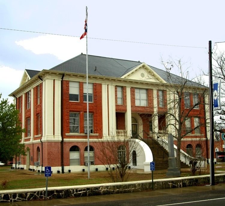
Named for Sabine River Website www.co.sabine.tx.us Founded 1837 | Area 1,494 km² Population 10,361 (2013) | |
 | ||
Rivers Patroon Bayou, Palo Gaucho Bayou, Brushy Creek Points of interest Mill Creek Park, Toledo Bend Lake, Indian Mounds Wilderness, Moore plantation wma | ||
Sabine County is a county located in the U.S. state of Texas. As of the 2010 census, its population was 10,834. Its county seat is Hemphill. The county was organized on December 14, 1837, and named for the Sabine River, which forms its eastern border.
Contents
- Map of Sabine County TX USA
- Geography
- Major highways
- National Protected Areas
- Adjacent counties and parish
- Demographics
- Education
- Cities
- Census designated place
- References
Map of Sabine County, TX, USA
Sabine County is represented in the Texas House of Representatives by Republican Chris Paddie, a radio broadcaster and former mayor of Marshall in Harrison County.
Geography
According to the U.S. Census Bureau, the county has a total area of 577 square miles (1,490 km2), of which 491 square miles (1,270 km2) is land and 85 square miles (220 km2) (15%) is water.
Major highways
National Protected Areas
Adjacent counties and parish
Sabine County in Texas and Sabine Parish in Louisiana are two of twenty-two counties or parishes in the United States with the same name to border each other across state lines. The others are Big Horn County, Montana and Big Horn County, Wyoming, Union County, Arkansas and Union Parish, Louisiana, Bristol County, Massachusetts and Bristol County, Rhode Island, Kent County, Maryland and Kent County, Delaware, Escambia County, Alabama and Escambia County, Florida, Pike County, Illinois and Pike County, Missouri, Teton County, Idaho and Teton County, Wyoming, Park County, Montana and Park County, Wyoming, San Juan County, New Mexico and San Juan County, Utah, and Vermilion County, Illinois and Vermillion County, Indiana. respectively. (Note, despite the different spellings, the source of the name is the same for Vermilion County, Illinois and Vermillion County, Indiana—the Vermillion River which flows through both counties.)
Demographics
As of the census of 2000, there were 10,469 people, 4,485 households, and 3,157 families residing in the county. The population density was 21 people per square mile (8/km²). There were 7,659 housing units at an average density of 16 per square mile (6/km²). The racial makeup of the county was 87.85% White, 9.92% Black or African American, 0.41% Native American, 0.09% Asian, 0.03% Pacific Islander, 0.82% from other races, and 0.88% from two or more races. 1.81% of the population were Hispanic or Latino of any race.
There were 4,485 households out of which 23.60% had children under the age of 18 living with them, 58.90% were married couples living together, 8.70% had a female householder with no husband present, and 29.60% were non-families. 27.00% of all households were made up of individuals and 15.40% had someone living alone who was 65 years of age or older. The average household size was 2.31 and the average family size was 2.78.
In the county, the population was spread out with 21.10% under the age of 18, 5.60% from 18 to 24, 21.10% from 25 to 44, 27.20% from 45 to 64, and 24.90% who were 65 years of age or older. The median age was 47 years. For every 100 females there were 93.40 males. For every 100 females age 18 and over, there were 92.70 males.
The median income for a household in the county was $27,198, and the median income for a family was $32,554. Males had a median income of $28,695 versus $21,141 for females. The per capita income for the county was $15,821. About 11.80% of families and 15.90% of the population were below the poverty line, including 23.90% of those under age 18 and 12.70% of those age 65 or over.
Education
The following school districts serve Sabine County:
