
Abbreviation SERVIR-Mekong Project | Legal status Active Website servir.adpc.net/about | |
 | ||
Formation 2015; 2 years ago (2015) | ||
SERVIR-Mekong project is a joint initiative by the US agency for International Development (USAID), NASA and five other countries which are Myanmar, Thailand, Cambodia, Laos and Vietnam. SERVIR is a Spanish word of Spanish origin which means to serve. The project aims to tap into the latest technologies to help the Mekong river region protect its vital ecosystem. It helps to connect USAID's development network with NASA's technology and satellite data to provide mapping information and satellite imagery.
Contents
History
The first such experimental hub was launched in Panama in 2005 to serve the near region. The project was initially undertook by researchers at NASA’s Marshall Space Flight Center in Alabama. In the Earth Observation Summit, 2007, SERVIR was recognized as a model for the effectuation of the Global Earth Observation System of Systems (GEOSS). In 2010, the organisation had presence in Himalayas when a hub, SERVIR-Himalaya, was established at the International Centre for Integrated Mountain Development (ICIMOD) in Kathmandu, Nepal. The organization has launched similar projects in past for other regions also like Latin America, Africa and Asia.
Target
The project stresses the vital issues associated in the Mekong river basin region which encompasses all the five countries which are also known as rice bowl of Asia. The project will also allow these countries to better deal with natural calamity issues and climate studies like green house gas emissions and effects. It also enables them to use their water resources more efficiently.
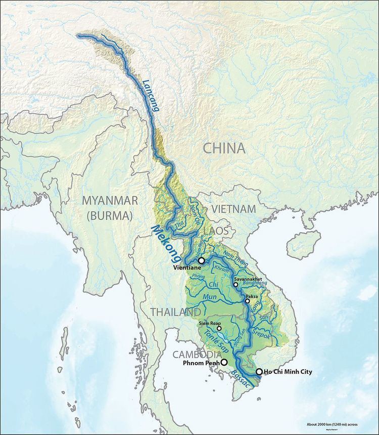
Geographical and Strategical Importance
The Mekong basin is very large which covers almost 5000 km from Tibetan plateau up to the South China Sea region. It gives livelihood to almost 40 million people. The environment is considered one of the most volatile ones in the world and it creates a lot of issues for the people every year. The project uses Space applications and helps to create geospatial data which is later analyzed to avoid natural disasters like floods and others in the lower Mekong region.
Implementation
The implementation of the project is undertaken by the Asian Disaster Preparedness Center (ADPC) in consortium with Stockholm Environment Institute (SEI), Spatial Informatics Group (SIG) and Deltares. The first phase of the project was launched on 31 August 2015.
Future Perspectives
SERVIR-Mekong is a good example of the technical collaboration in the region and development of a common analysis. It also aims to see environmental planning agencies leading in technical support and take better development decisions. SERVIR has also served in development of more than 30 countries of Latin America, Africa and Asia which includes providing tools and training to thousands of people of the region.