
Postcode area SE Post towns 1 Postcode sectors 129 | Postcode districts 30 Postcodes (live) 20,305 | |
 | ||
Se postcode area
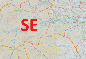
The SE (South Eastern) postcode area, also known as the London SE postcode area, is the part of the London Post town covering part of south-east London, England. It loosely corresponds to the London Borough of Southwark, London Borough of Lewisham and Royal Borough of Greenwich, the northern part of the London Borough of Croydon, the eastern part of the London Borough of Lambeth, the western part of the London Borough of Bexley and the northwestern part of the London Borough of Bromley.
Contents
Postal administration
The Postcode area originated in 1857 as the SE district. In 1868 it gained some of the area of the abolished S district, with the rest going to SW. It was divided into numbered districts in 1917, by giving the district closest to London and the location of the head office the suffix "1" and then each district assigned a number alphabetically based on the location of the main office within the district. SE28 is a much later addition carved out of the existing districts SE2 and SE18 in order to accommodate the development of Thamesmead. Unlike in the SW postcode area, where districts are also split into two alphabetical tranches, SE1 is the only head district, and although the numbering begins again at SE19 this is not a head district. The postcode area is part of the London post town. There are no dependent localities used in the postcode area. SE1P is a non-geographic postcode district for PO boxes located in SE1.
List of postcode districts
The approximate coverage of the Postcode districts, with the historic postal district names shown in italics:
Boundaries
Postcode districts SE1 and SE11 have extensive River Thames frontages and are central to London. SE2–SE18 are organised in the northern part of the postcode area, with SE2, SE7, SE8, SE10, SE16 and SE18 also fronting the river. Postcode districts SE19–SE27 form a group in the southwest and SE28 is located in the extreme northeast. The postcode area maps roughly to the combined area of the London Borough of Southwark, London Borough of Lewisham and Royal Borough of Greenwich. the eastern part of the London Borough of Lambeth, the northern part of the London Borough of Croydon, the western part of the London Borough of Bexley and the northwestern part of the London Borough of Bromley are within the postcode area.
In 2002, a small group of residents in the West Heath area wished to have their postcodes changed from SE2 to the adjacent DA7 postcode district, citing higher insurance for their houses, belongings and cars as reasons to change. Royal Mail has said it will not consider changes to postcodes for these reasons.