
Basin size 212 km² Basin area 212 km² | Reference no. DE: 48828 Length 38,000 m | |
 | ||
Tributaries Left: Alte Söse; Right: Große Bremke, Sülpkebach, Markau | ||
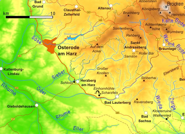
The Söse is a right tributary of the river Rhume, 38 kilometres long, in Lower Saxony, Germany.
Contents
Map of S%C3%B6se, Germany
Geography
The river rises on the plateau of Auf dem Acker in the district of Osterode in the southwestern part of the Harz Mountains in Germany. From there it flows initially westwards; and is then impounded at a pre-dam and then by the Söse Dam between the Osterode village of Riefensbeek and the town of Osterode am Harz itself. In Osterode the river bends northwest, only to swing westwards near Badenhausen and then southwards near Eisdorf just a few kilometres west of the Harz. It flows in that direction through Osterode-Dorste before entering the westward-flowing Rhume between the villages of Berka and Elvershausen, both part of the borough of Katlenburg-Lindau in the district of Northeim.
Tributaries
Walking
At the confluence of the Great Söse and the Great Morgenbrod is the Morgenbrodt Hut (ca. 600 bis 605 m above NN; 146 – Morgenbrodt Hut 51.76260°N 10.44573°E / 51.76260; 10.44573). This spot is no. 148 in the system of checkpoints in the Harzer Wandernadel hiking network. The Morgenbrodt Hut was demolished in 2013 by the National Park Authority as it was falling down and it is not intended to be replaced.