
Time zone CET (UTC+1) | Frazioni Plan Postal code 39048 Elevation 1,563 m (5,128 ft) Local time Tuesday 12:54 PM | |
 | ||
Region Trentino-Alto Adige/Südtirol Weather 9°C, Wind N at 3 km/h, 70% Humidity | ||
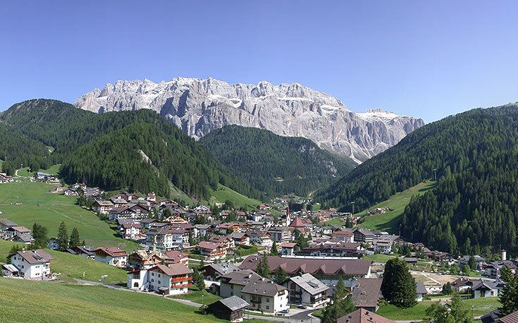
Sëlva ( [ˈsɜlva] ; Italian: Selva di Val Gardena [ˈselva di val ɡarˈdeːna]; German: Wolkenstein in Gröden [ˈwɔlkn̩ʃtaɪ̯n ɪn ˈɡrøːdn̩]) is a comune (municipality) in the Val Gardena in South Tyrol, northern Italy, located about 30 kilometres (19 mi) east of the city of Bolzano. The Ladin place name derives from the Latin word silva ("wood").
Contents
- Map of SC3ABlva Province of Bolzano South Tyrol Italy
- Geography
- Coat of arms
- Linguistic distribution
- References
Map of S%C3%ABlva, Province of Bolzano - South Tyrol, Italy
Geography
As of 30 December 2010, it had a population of 2,637 and an area of 53.2 square kilometres (20.5 sq mi). Sëlva borders the following municipalities: Badia, Campitello di Fassa, Canazei, Corvara, San Martin de Tor, and Santa Cristina Gherdëina.
It is perhaps best known as one of the starting points of the Sella Ronda ski tour.
Coat-of-arms
The emblem is quarterly, the first and third corners are per bend and per fess nebuly of argent and gules; the second and third corners are indented of azure and argent on a sable top. The emblem represents the insignia of the Lords of Wolkenstein who built the local castle in 1291. The emblem was adopted in 1968.
Linguistic distribution
According to the 2011 census, 89.74% of the population speak Ladin, 5.11% Italian and 5.15% German as first language.